Grumpy Old Men's Climbing Club 2023
March | April | May | June | July | Svalbard |August | September | October| November | Group Shot | Quiz | XmasCrack
- The Moving Finger writes; and, having writ
- Moves on: nor all thy Piety nor Wit
- Shall lure it back to cancel half a Line,
- Nor all your Tears wash out a Word of it.
- Omar Khayyam knew a thing or two about emails...
Hello?
Is there anybody in there?
Just nod if you can hear me
Is there anyone at home?
Come on now
I hear you're feeling down
Well, I can ease your pain
And get you on your feet again
Relax
I'll need some information first
Just the basic facts
Can you show me where it hurts?
There is no pain, you are receding
A distant ship smoke on the horizon
You are only coming through in waves
Your lips move, but I can't hear what you're saying
When I was a child, I had a fever
My hands felt just like two balloons
Now I've got that feeling once again
I can't explain, you would not understand
This is not how I am
I have become comfortably numb
Just in case there is life on Mars, and as a reminder that we have a communal wbsite, here are a few pics. One from The Gravelings, and a few from me. Those on Facebook will have seen many of these.
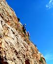
Pic from John Graveling at Maria, showing High Fox on Fox up a Tree and Keith Wylie on No route for old men.
1-5
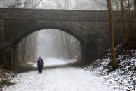
- Winter Walking on the Monsal Trail.
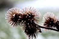
- Icy Burdocks
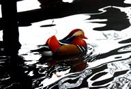
- Mandarin duck at foggy Longshaw.
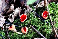
- Elf Caps (or cups) in Lathkill Dale.
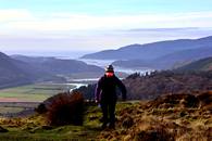
- On the Old Precipice walk near Dolgellau.
6-11
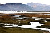
- Mawddach estuary
- Overheating near Dolgellau
- In terra incognito near the Aran Hills.
- I think that we're lost.
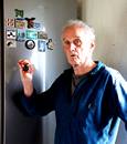
- Relocating our 74 fridge magnets on the new fridge door.
- There they are.
12-16
- Sue makes a bold attempt on the Cork Stone on Stanton Moor.
- In the old quarry workings on Stanton Moor.
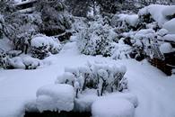
- Our snow's deeper than your snow.
- 14 inches of snow, our garden is somewhere under there.
- Keeping the mail cosy, St David's day Llanberis.
17-21
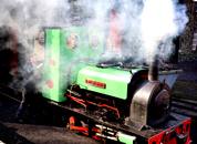
- Padarn Lake railway engine firing up.
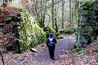
- Lakeside path.
- Snow on Snowdon
- A view through Dolbadarn castle
- Sheltering from the rain in Dinorwic Quarries.
CAPE TOWN CYCLE TOUR 2023
MIKE BROWELL
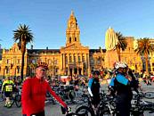
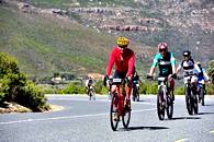
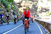
After a gap of three years due to Covid 19, I returned to South Africa in March to compete in the world’s largest timed bike race.
Up to 35,000 cyclists have taken part in past events but this years numbers were down to 28,000. Of these, 10,000 just did a short course of 42km. The other 18,000 including me rode the full 109km route on closed roads from Cape Town to the Cape of Good Hope and back. My thirteenth event, which is nothing really: at Race Registration there was a posted list of several hundred who have ridden 21 tours and entitled to purchase a yellow jersey!
Things have changed over the years I’ve been racing this course. It used to be called the Cape Argus Cycle Race, organized by the Cape Town newspaper, The Argus.
About 6 years ago the local fire-raisers thought it would be great fun to set fire to the bone dry mountain slopes through which the race passes. They targeted their activities to the weeks leading up to the race, causing serious damage to property and risk to life. The Cape Town emergency services were very concerned that a fire on race day with 35,000 bikes clogging up the road would be a potential disaster. The race was cancelled once and shortened once. Our esteemed friend Roy Small was a beneficiary of the shortened race.
The Cape Argus newspaper recognized that they, the media, were attracting publicity seeking hooligans. They stepped back and handed the race administration over to Cape Town city. There were no fires during the race in 2020, or 2023.
Before the race, days in the sun
Cape Town is very hot in March. Typically 30C plus. I arrived two weeks early and set out on increasingly long solo training rides, usually finishing at a vineyard restaurant to meet Linda for lunch. Its fair to say that some of the training rides were quite dangerous due to massive double trailer lorries, laden with fruit from the orchards to the east.
The place we stay is in the Cape Winelands, one hour from Cape Town. Franschhoek, Frenchmans’ bend, is at the foot of a massive mountain reserve. The mountains are spectacular, bare rock peaks up to 1500 metres. I have ventured into the mountains, but not fully taken on the challenge of a big multi-day traverse. Paths are rare, huts rarer, water is usually absent.
There are two big passes, Stellenbosch Helshougte and Franschhoek Passes. For cyclists they are hard to avoid. Luckily Franschhoek Pass has a permanent spring just below the summit.
In 2020 Stuart Gascoyne joined me in South Africa and that justified an ascent of Table Mountain by the India Venster Skeleton Ledges route. It is a tough scramble with terrific exposure and frightening drops. At the top is a warning sign reading ‘This is not an easy way down’
Fires and Flora
The Cape has a unique floral kingdom known as Fynbos, meaning fine leaved bush. Table Mountain alone has 8500 fynbos species. The British Isles have 2500 species and half of these are imported.. It is a ‘fire climax’ habitat, controlled naturally by fire originally caused by lightning strikes but now more typically from fires on the edge of towns. Once ignited, the fire races over the sparcely vegetated mountain sides. In natural fynbos there are no full size trees: the fires re-occur a few years apart and native trees don’t reach any great height.
Unfortunately the settlers who arrived from Europe 300 years ago to colonize and grow crops to supply ships passing through Cape Town Harbour, brought with them non-native trees including conifers. Franschhoek valley has many pine and eucalyptus shelter belts. Fires are catastrophic, the trees burn long and very hot. In summer 2020 many Franschhoek residents abandoned their homes when forest fires turned in their direction.
The Race, the Main Event
Cape Town wakes early on the second Sunday in March. The elite racers set off in the dark. My start time, earned by previous respectably fast completions, was shortly after dawn at 7:21am. Tom Westgate please note, the temperature was a chilly 13C!!
The race starts with a long hill over the north flanks of Table Mouintain. There are always early crashes, and sure enough there was an ambulance on Hospital Bend where cyclists risk their first fast descent at speeds over 50kph.
The second hill is Edinburgh Drive, always thronged with partying crowds, live music, and early morning drinkers. That’s where I have to use my final gear for the first time.
Then the eerily empty motorway, a long descent into the coastal towns of the Cape peninsular. There are no cars, the roads are all closed but traffic lights are still live, mostly on red, and there are occasional pedestrians trying to cross the wide roads between groups of bikes.
Finally the last houses are cleared and the road rises sharply (last gear again) to cross the peninsula The terrain is fynbos but the road has a shelter belt of eucalypts and conifers where the local baboon troop likes to hang out. In previous years the baboons are lured away by generous food placed for them a long way from the bike race. Not this year, a small number were playing close to the road and you wouldn’t want to run into one.
A long descent reaches the sea on the west coast at Misty Cliffs. A strong onshore wind was causing rolling waves and plenty of mist. Here the cyclists take advantage of a few kilometers of shade before emerging into mid-morning full sun for the final 40km into Cape Town.
Crowd support is always great on the last section but the cyclists know that the two hardest climbs are coming up, Chapmans Peak and Suikerbossie. Chapmans Peak is a ‘scenic drive’ and has payment kiosks at each end. The narrow road is partially covered to protect from rockfall. Spectators cant get into this section and it’s just as well as the road has a vertical drop-off into the sea. Wobbling cyclists face a possibility of tumbling over the low wall.
Suikerbossie is a totally different proposition. It is 6 lanes wide, 1.6km long and in full sun. Supporters offer drinks and sometimes hosepipes. My strategy is to engage the lowest gear and count down the road signs. There are 27 on my turbo-trainer video.
The six lane descent continues into the south suburbs of Cape Town and are taken at speed, sweeping wide bends allow speeds up to 60kmh at my position in the race. The beach resorts pass in a blur and the flat final 10km into the finish are lined with supporters.
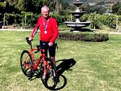
Off the bike for the first time in 5 hours, wobbly steps into the 6 lane finish funnels and on to receive my thirteenth medal and a full fat Coca Cola. If you wobble too much the First Aiders grab you and whisk you off to a recovery tent!
1-5 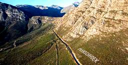
6-11
12-16 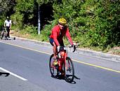
Photos
1 Franschhoek valley vineyards and orchards
2 Franschhoek Pass – geocache on the F
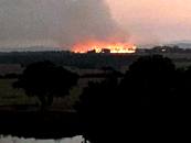
3 Franschhoek fire in 2019
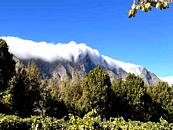
4 Like Table Mountains cloud ‘tablecloth’ waterfall over the Franschhoekberge
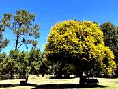
5 Acacia tree
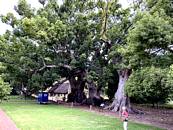
6 Camphor trees over 300 years old at Vergelegen
7 Quiver tree used by bushmen hunters
8 Stuart Gascoyne about to tackle the India Venster climb up Table Mountain
9 This is not an easy way down sign
10 Grape picking on a small wine estate
11 Iconic 250 year old Stone Pine avenue at Neethlingshoff
12 Cape Town Cycle Tour west coast
13 Chapmans Peak Drive with scary low wall and the sea a long way below
14 The dreaded Suikerbossie, the last climb
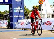
15 Finish in 10,000th position
16 Back in the vineyard
Derwent Village Ladybower
The submerged village which launched a Facebook Group with over 1700 members
Mike Browell April 2023 (mike.browell@btinternet.com
Some of the Grumpies will know that I have a trio of projects on the go at present.
One of them is to get a full set of Sheffield Clarion Ramblers Handbooks scanned and available on line. There were 61 annual editions from 1902 to 1963, all written by Bert Ward, who founded the club
The second is to share locations of interesting sights in the Peak District. This started from an idea of Geocross trail, a contactless geocache devised by Stuart Gascoyne.
The third is the now submerged village of Derwent which I visited a few times in the dry summer of 2022. There is a dedicated Facebook Group with over 1700 members. When you think that this was just a tiny village of no more than 200 people, that’s quite a fan club. Adey Hubbard noticed that the Sheffield Clarion Ramblers had visited Derwent on 15 April 1923, and this year on 15 April is the Centenary.
So I produced a Geocross, most of which cant be seen except in the next dry summer..
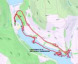
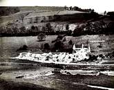
Demolition of Derwent Hall by Henry Boot and Sons. The site of the glasshouses can be seen higher up the bank.
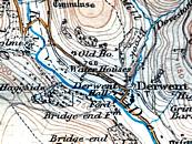
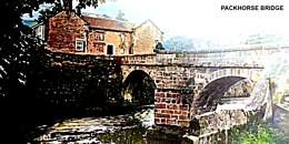
This extract is from The Peak District OS map. It is the 1936 revision of the 1924 first edition. There is a ‘Ford’ named in Derwent Village, where the packhorse bridge used to stand, close to the gates of Derwent Hall. The bridge was first built in the 17th Century and became a Scheduled Ancient Monument. It was carefully taken down prior to 1935, when construction of the Ladybower Reservoir began. Each stone was numbered, and put in store for later rebuilding. It was finally rebuilt at Slippery Stones and opened in 1959.
On this map, Bridge End Farm no longer has a bridge, and the road to the bridge is shown dotted.
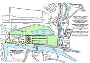
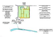
The vegetation visible in September 2022 after a long dry summer defines the topsoil cultivated areas and the gravel paths. It is interesting because all the emergent annual species are from seed which has lain submerged for 20 years. Most reservoirs have a draw-down margin where the waterline recedes over summer and new vegetation establishes in tidal bands. It then has a short season for flowering and seeding before gadually becoming inundated by rising water levels.
This Kitchen Garden is different. It spends many years deeply submerged beneath 6 metres of water, then, being flat, suddenly emerges when the water level drops. It begins as waterlogged soil but rapidly dries out and seeds germinate, flower and seed. Then as water levels rise, these gardens suddenly disappear below water for another few years.
Derwent Village emerged in 1976, 1989, 1995, 2003, 2015, 2018 and 2022.
The common weeds present in 2022 were all annuals, and in order of quantity:-
Red Goosefoot Oxybalis rubra
Water-pepper Persicaria hydropiper
Amphibious Bistort Persicaria amphibea
Water-purslane Lythrum portula
Silverweed Potentilla anserina
New Zealand Pigmyweed Crassula helmsii
Fat-hen Chenopodium Album
Procumbent Pearlwort Sagina procumbens
Marsh Cudweed Gnaphalium uliginosum
Marsh Yellow-cress Roprippa palustris
These were identified by horticultural expert John Middleton, a specialist in Derbyshire reservoir drawdown flora. It is worth noting that there were very few grass species present. Grass seed ripens over summer and is dispersed locally.
The Derwent Hall Head Gardener would have been mortified to find so many annual weeds infesting his finely cultivated gardens. In his day there would be no use of modern chemicals, just manuring, weeding, fallowing and a lot of hand digging. He would however have been pleased to see that his gardens have been preserved by flooding, and did not revert to sheep pasture.
South of the ‘Water House’ was a walled paddock possibly for ponies or donkeys to pull carts of produce for delivery to Derwent Hall. Or it may have been a pig sty, or poultry pens.
There was a coal fired heated glasshouse in the north-east corner. Various cut off stumps suggest there might have been ornamental small trees, possibly yew as topiary.
SHEFFIELD CLARION RAMBLERS VISIT DERWENT 15 April 1923
Mike Browell April 2023 (mike.browell@btinternet.com)
Posting this on 15 April 2023, on the centenary of a historic ramble.
100 years ago today on 15 April 1923 a group of long distance ramblers passed through Derwent village, possibly 40 or so men and ladies. These were members of the Sheffield Clarion Ramblers and they were tough people. They had come out from Sheffield on the 8:35am train to Bamford and were on their way to Bradfield, a walk of some 19 miles. It would take them all day, and they caught the bus home.
They were led by Mr W Bagley who knew the route well. The Peak District Ordnance Survey 1 inch to the mile map had been revised in 1921 but not all the ramblers would have a copy. Their club had been visiting Derwent in spring since 1914. In 1920 a similar walk took place on 28 March and was led by Mr GHB Ward himself.
Sheffield Clarion Ramblers was a club set up by GHB Ward in 1900, to encourage working men and ladies to enjoy some healthy outdoor exercise on every Sunday of the year. It was their only free time, most men worked on Saturdays.
These were not country folk. They lived in town and learnt the ways of the moorlands and valleys by rambling. By 1923 the club had celebrated its’ 21st Coming of Age year. Membership numbers had risen to around 1000 and they printed 1500 handbooks annually. Those who took part in this ramble had survived the First World War, although the number of young men was much reduced.
The rambles were the main purpose of the club, and they took place every Sunday. Bert Ward appointed The Leader and gave the following Hints:-
The Ramble will be taken, wet or fine.
The Leader must follow the printed route.
He will wear a distinctive badge and will appoint a whipper-in.
He has full charge of the arrangements for the day and members must consult him upon matters affecting the pleasure and convenience of the party.
But he cannot be responsible for a large party.
As members should themselves write beforehand.
He is expected to provide a reading of useful information upon place names etc, from Ramblers Booklets or other sources.
And to see that some song is sung along the way.
On the morning of 15 April 1923 they walked from Bamford Station to Ashopton on the old road positioned lower on the valley slopes above the River Derwent. At Ashopton there was no towering viaduct. They turned right onto Ashopton Road which led to Derwent Village. They would not have been able to see the recently completed Derwent Dam due to a bend in the valley, but their leader would have told them that it was completed in 1916, the largest water engineering project in Britain.
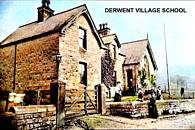
Entering Derwent village they passed the school and crossed a bridge over Mill Brook. Ahead was the grand house of Derwent Hall and to their left was the narrow packhorse bridge over the River Derwent. Their route today would follow the packhorse trail east over the skyline of Derwent Edge and down to Bradfield.
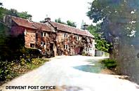
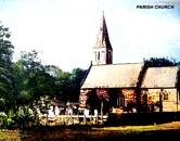
In Derwent village they would have noticed the missing generation of young men who died in the First World War. The Derwent Inn had closed in the 1870s, so they might have stopped at Mill Cottage for refreshments. They might also have visited the war memorial in the grounds of the Parish Church of St James and St John.
Few would have thought about what the future had in store for Derwent village. That was 25 years into the future and another World War away.
Mr W Bagley would have explained that the Derwent Valley Aqueducts carried water from the Howden and Derwent reservoirs by gravity flow to the Bamford Water Treatment Works. He would also have reminded his Sheffield group that their city had the benefit of 5 million gallons of water every day since 1916, passing through the 5 mile Rivelin Tunnel. The rest of the water went to Derbyshire and the cities of Derby, Nottingham and Leicester.
He may have mentioned the temporary Tin Town of Birchinlee, built to house up to 900 workers and their families between 1902 to 1916. This model town was a couple of miles upstream from Derwent and had two hospitals, a school and mission room, post office, greengrocers, cobbler and hairdresser, clothier and drapier, confectioner and tobacconist, bath-house, a recreation hall and police station. Of specific interest here was the ‘Derwent Canteen’, which was licensed to sell beer.
Tin Town dwarfed the tiny village of Derwent.
After refreshments their Leader would have led them off up the holloway to Green Sitches, over the summit of Lost Lad and on to Bradfield Gate Head. They were asked to walk this section IN SINGLE FILE (as it says in the Handbook) so as not to trample off the packhorse trail
Some of the rambling group would have carried a little booklet, a Sheffield Clarion Ramblers Handbook. Bert Ward wrote these every year giving a list of the rambles and their dates, name of the leader and any money needed for refreshments.
He promised his members that the Leader would always lead, whatever the weather, and he or she would point out and explain features along the way. The really interesting part of the handbooks was the pages of local and social history comment which Bert Ward authored.
The cover page always had the same two mottos
A rambler made is a man improved
A man who never was lost never went very far
1-3 

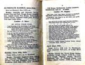
If you wanted a copy of the 1923 Handbook it might set you back £50 today, but what a slice of social history you would be acquiring!
4-7 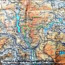
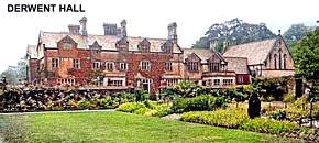

PS The Duke of Norfolk sold his property in Derwent to the Derwent Valley Water Board in 1924. Sheffield Clarion Ramblers continued to revisit Derwent every year from 1924 until 1928. They named their destination as ‘Derwent Chapel’ although this was the Church of St James and St John. 1928 was their last visit.
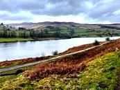
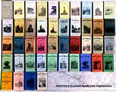
Derwent on 15 April 2023
I wonder what these intrepid ramblers would make of the fact that 100 years later, over 1700 people would be so interested in the now submerged village of Derwent that they have shared hundreds of pages of memories. .
June. The Hubbards have been away again, towing their home behind tham North and South this time, we look foreward to the foillow up East and West. Great Yarmouth and Ardnamurchan?
Adey & Jan in Sussex – April 2023
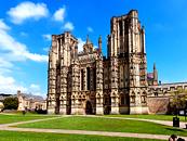
We were unexpectedly able to negotiate mum-in-law “watch”, at fairly short notice, and wondered where to go. Too wet and chilly for Scotland; several trips to Dorset, Cornwall, Devon and Kent and the Cotswolds over the last few years, so what to do? Then it struck me that we had driven through the South Downs on the way to the ferry at Newhaven but never stopped. Problem solved and a pitch sorted at the Brighton Caravan Club site. On the way down we stopped at Bristol to use our tickets for the SS Great Britain (Pics 1 & 2) and visit Tyntesfield, another place we had often driven past. One more day to use up found us at Wells (Pic 3), which turned out to be market day as well as warm and sunny. And so, onwards to Brighton. This turned out to be a really good site, albeit ridiculously expensive, on the edge of lovely walking country. Brighton, however, had only two merits; the ridiculously over the top Royal Pavilion (Pics 4 & 5) and The Lanes with its quirky shops, cafes and restaurants. Otherwise, it appeared tatty around the edges and, with parking being £10 minimum, we only went once.
1-5 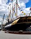

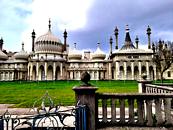
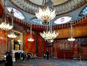
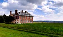
The walking was a much better option, along superb ridges and down into dry valleys. All very reminiscent of the Wolds Way but with bigger hills. We started off at the Devil’s Dyke (Pic 6) with an excellent warm up to the villages of Poynings and Fulking, followed by a short but steep climb back onto the ridge and along to the car. Not wanting to over-stress our aging frames and knowing that the weather was going to be pretty warm, we divided our time between walks on the Downs and visits to National Trust properties, on the grounds that we had the cards so needed to justify their cost. So, we drove to Battle to visit the Abbey and walk a chunk of the 1066 Country walk that was not quite as clearly signed as the information board suggested. Other days saw us at Petworth House, which is fantastic if you like quality paintings and the idea that it was in the Percy family for 900 years; as if Alnwick Castle wasn’t enough! We liked the way that it was virtually part of the town, with one of the entrances opening almost directly onto the main street. We also went to Uppark (Pic 7) where one Sir Harry Fetherstonhaugh, aged 71, married one of his dairy maids (aged 20). When he died, 20 years later, she inherited the house and the 5000 acres and over 200 staff that went with it. Not bad for a penniless maid from a poor family. When she died, she left the estate to her sister, who assumed the Fetherstonhaugh name but died childless, leaving it all to an army officer. He promptly also assumed the name but then bequeathed it to another military man, who decided to call himself Admiral, The Honourable Sir Herbert Meade-Fetherstonhaugh, of no family kinship whatsoever, and his distant cousins now occupy the upper floor. All very weird. Finally, we visited Standen House & Garden (Pic 8), which is a marvellous example of an Arts & Crafts house full of William Morris interiors and with wonderful gardens that kept Mrs. H happy for hours.
6-8 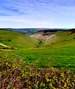
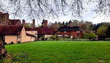
For rather more exercise we went along the Seven Sisters (Pic 9) to Beachy Head (Pic 10) and decided that Alistair Crowley was either a mountaineering genius or completely bonkers, never mind Mick Fowler on Monster Crack, which looked utterly horrendous from above. Much more appealing were circular walks from Ditchling Beacon via the Clayton windmills and from the lovely village of Alfriston (Pic 11), taking in the Long Man of Wilmington (Pic 12) and the Littlington White Horse (Pic 13). On our last day we took a short drive to Telscombe which, despite being only a couple of miles from the caravan site as the crow flies, was a different world altogether. We saw only a handful of people all day, whilst walking through a couple of superb dry valleys and an extensive ridge (Pic 14). All the routes gave marvellous views over the Downs and the Weald, as well as across the Channel (Pic 15).
9-13 

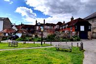


14,15 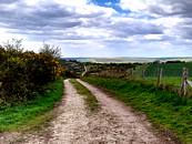
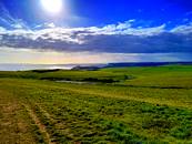
Would we go again? Definitely, early in the year, as there is a vast area we did not venture into at all. Would we stop at Brighton? Probably not because, although it provides easy access to everywhere we wanted to go, it has no other obvious attraction and is expensive.
Mull and Loch Lomond 2023
Here is a tale of sun, wind, rain, a lost camera and a Munro.
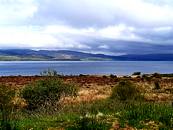
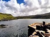
A week after getting home from Sussex we set off again, this time on a long-planned trip north. We like Scotland in May as the weather is often reasonable and the midges are still asleep. So, an early start from home and 8 hours towing later we rolled up at the brilliant Caravan & Motorhome Club site at Killin, right next to Loch Tay (pic1) where a meal at the excellent Courie Inn (where the SNP had not stopped them from celebrating the coronation the day before) set us off to a fine start. The next morning, we carried on to Oban for the ferry to Mull and onto another brilliant site at Salen Bay, overlooking the Sound of Mull and ideally placed to access the whole of the island (pic2).
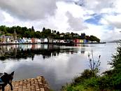
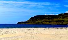
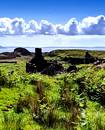
I had been to Mull before, with DofE expedition groups, but this was Jan’s first trip so we used up the second day’s sunshine with a tour of the best of the northern part of the island. This took us to Ballamory – oops! – Tobermory (pic 3), over the top to Dervaig and onwards to Calgary Bay (Pic 4). Here we walked a short section of the raised beach as far as a disused jetty (Pic 5), which was built to take cattle and sheep to summer grazing on the Treshnish islands, and where we watched sea and golden eagles for a long time before returning to the very good café for some lunch and then over to Ulva Island, where super views of Ben More (Pic 6) led us onwards to the Old Boathouse café and really good tea and cake.
1-6 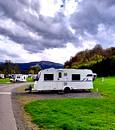
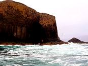
The following day we were back in Ulva to pick up the Taurus Mara boat trip to the Treshnish Islands, where we landed on Lunga to see the puffins (Pic 7) and a massive nesting colony of guillemots and razorbills on Harp Rock (Pic 8). There were also shags nesting in nooks and crannies in the rocks. The bird photos clearly show the lovely weather there but as we left Lunga to sail towards Staffa the clouds arrived, the wind blew, the rain came and the waves got bigger and bigger. The Fingal’s Cave shot (Pic 9) is a good indication that a landing on Staffa would have been impossible and attempted access into the cave sheer lunacy but it was all very dramatic. A few people could not contain their lunch and it was a weather-beaten bunch of tourists who finally arrived back at Ulva mostly in one piece but, for a few, a pound or two lighter in weight. We visited Duart Castle, for 700 years the home of Clan Maclean, but there are no photos due to me losing the camera the next day and not taking any shots on the mobile.
We had with us the Cicerone guide to walking on Mull. It was much better than some in the series, which have sometimes directed us to difficult, dangerous or downright impossible routes. This guide, along with a personal recommendation, found us on a superb walk round the Treshnish peninsula, presumably so named because you can see the Treshnish Islands from it. This was an excellent walk with rugged coastal scenery, where we took the adventurous option on sheep tracks just above sea level, rather than the safer route on the raised beach higher up. Along the way I managed to leave the camera on the ground instead of fastened to the rucksack. A couple of days later, when I went in search of it and knowing exactly where it had been left, it had gone. So much for the honesty of fellow walkers, of which there were very few. Either that or the sheep used it as a football and kicked it into the sea. That’s why there are few photos of the first four days and all those I do have are taken on a mobile and not a camera. The guide led us to Iona, where we visited the Abbey (Pic 10) for free – thank you English Heritage – and had a walk across the island to a golf course and fabulous beach (Pic 11).
7-11 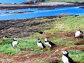
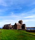
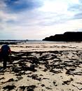
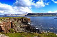
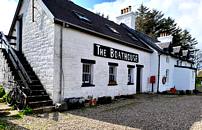
On the following day, after I had charged round the Treshnish walk again in search of the camera, we made the best of the remaining day by driving to Lochbuie (Pic 12). This turned out to be a wonderful bay with an equally superb café and lots of really interesting history covering at least 3000 years (Pic 13). Another place not to be missed. One of the advantages of our campsite was its views across the Sound of Mull. We woke to sunshine and dolphins swimming towards Tobermory and then set off, once again, for Ulva where we walked out to Ormaig. This is one of the highland clearances village remains and is really remote, with fantastic views towards Dutchman’s Cap in the Treshnish archipelago (Pics 14 & 15). We returned via the ruins of a croft once owned by David Livingstone’s grandparents and which he visited regularly before he turned into an explorer and, perhaps, somewhat dubious missionary. On the coast we found basalt columns (Pic 16) like those on Staffa and the Giant’s Causeway, lots of flowers in the machair section and a completely unspoilt area of natural woodland that was full of warbling birds (at least two were definitely warblers anyway). Once again, The Old Boathouse (Pic 17) kept the body sustained after the island had uplifted the soul. Ulva really is a pretty special place. On the way back we met Bill Geary, in Tobermory, for a pint. He was crewing a mate’s boat that, along with several others, had taken two days to get from Oban against the strong north-westerly winds. On the following morning we watched some of them do the return trip down The Sound in about two hours. Our only thought was …. WHY?
12-17 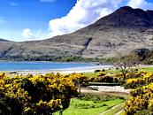

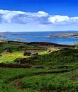
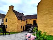
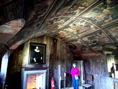
After nine days we left Mull, bound for the Milarrochy Bay site on the eastern shore of Loch Lomond and got pitched up and organised. We went to Stirling where the castle (Pics 18 & 19), which puts the one in Edinburgh to shame, was also free courtesy of English Heritage. There was enough time left to drive further to Culross Palace (Pics 20 & 21). This isn’t a palace but, rather, a wealthy merchant’s house but it is all made very interesting because most of the small town is from the same 16th century era. Another free visit, this time because of the reciprocal rights with the Scottish National Trust.
18-21 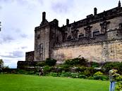

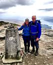
Three days left and we made the most of the good weather by ticking off Ben Lomond via the circular route, up the Ptarmigan ridge and down the tourist path (Pic 22 – 24). It was fairly warm and the views were good, so we took our time (nothing to do with lack of fitness, obviously). At the top, whilst we were having lunch, we met a man with his sister and daughter who were helping him to celebrate the ascent as he completed all the Monros. We also became aware of a teenage girl, with her family, who was carrying a cafetière-sized box around the summit. It was not until they were about to leave when we realised, as her dad said, “We had better put my dad back in the rucksack now”, that she was carrying an urn containing his ashes. This was not to scatter them but to take him up his favourite mountain one last time. All quite moving, actually.
22-25 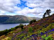

On the following day we drove out to The Hill House (Pic 25); thanks again, National Trust. This Charles Rennie Mackintosh building is encased in an ingenious, breathable metal cage to keep the rain off. He had covered it with cement render but, not knowing much about how this new material worked, did not protect against water ingress so the whole coating has now become rather like sugar icing. It is crumbling away and water is getting into the house. Since it is the most complete CRM designed and furnished private house anywhere there has been a mad rush to protect it, whilst the experts work out how to conserve it for the next 100 years. From there we moved on to Gielston gardens, near Helensborough, which was a small gem that would keep Mr. & Mrs. Jackson busy for hours – good old NT again. Finally, we drove up Loch Long and Arrochar for a peek at The Cobbler, which we had intended to include in our walking but just didn’t have time for. The last day was spent with Jan’s cousins, who live in Erskine, and who we only see when we are going across the border to the northwest. We had fitted a lot into our two weeks of freedom, thanks to Jan’s sister and brother-in-law who looked after her mum whilst we were away.
Chris and Sue in the Southwest, May-June 23.
Adey and Jan seemed to have thrown down a gauntlet, so to speak, so here are some pictures and text from our recent trip to the southwest. Far too many pics and locations to do the trip real justice, they will have to wait until later in the year in our Blurb book for 2023. However, here is a snippet of our trip, most of it on the Scillies but with other bits wrapped around it for completion.
1-5
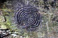
Start of our huliday, we stayed for a few days at the rather expensive CAM site near Tintagel, well not that near, about a 2 mile hike actually. Below the campsite was Rocky Vally, so called because its full of rocks and had some rock carvings. These are the rather mysterious Labyrinthine Pattern carvings, purpose unknown but thought to date from the Bronze Age, some 1800 to 1400 BC.
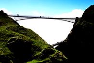
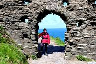
As you do, we visited King Arthure's castle across Tintagel's new rip-off bridge. Had we not been members of English Heritage we would have been paying £20 each for the privelege and very little castle on the other side. Next day we took the bus to Crackington Haven just up the coast and walked back to the campsite via Boscastle along the coast path. We discovered that we were not all that coast-path-fit and the 10.5 miles and 850m of ascent caused us some hardship.
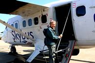
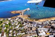
We moved to Trevedra Farm campsite which was only a couple of miles from Land's End airport, our taking off point for the Scillies. Handily, the campsite stored our campervan for the week that we were away. No campervans in the Scillies as they are rather lacking in roads. We took a taxi to the airport and took the 20 minute flight on a Twin Otter to St Mary's the largest of the islands. Land's End airport has the dubious reputation of being the world's most expensive airport. £121 single to St Mary's and no in-flight sandwiches. What! Picture 5 showns Hugh Town, the St Mary's capital from the air. Our self catering accommodation was just bottom right.
The Scillies is an archipeligo of five inhabited islands, silver sand beaches and rocky excrescences, the islands rise to a maximum of 51m and are situated 45km southwest of Cornwall. The main Islands are St Mary's, St Martin's, Tresco, Bryher and St Agnes. There are also dozens of uninhabited islands, lots of birds, rare plants and a famous lighthouse, Bishop's Rock. We visited the Scillies a few years ago in the autumn, and sailed there on the bumpy Scillonian III, an old rather flat bottomed boat which is due to be replaced by the spanking new Scillonian IV next year, new prices to be announced we suspect. Scillonian I was wrecked, Scillonian II was soon replaced by the current Scillonian III
The weather was sunny but with a cool easterly blowing most of the time.
6-10
We stayed at Dunmallard upper flat in Hugh Town St Mary's which was immaculate, it had wifi but no charging points otherwise hard to fault other than it being quite expensive, £750 for the week. We circumnavigated St Mary's which was about 8.5 miles and noted several rocky sections around the south and west sides, there must be climbing here. St Mary's has lots of Entrance Graves and ancient stones, many which date back to the Neolithic period. Next day we took the ferry from the Quay at Hugh Town to Tresco. These little ferries run every day to the various islands. Typical cost, about £13 return.
11-15
The Abbey gardens at Tresco were magnificent, and we reckoned that they were the best gardens that we had ever visited, and we've visited quite a few over the years. After the gardens we visited its tea room, then we circumnavigated the island which was very beautiful, with lots of skerries and bottom-ripping rocks as far as the eye could see. We also located the rare Sea Dock which was less impressive. Pic 15 is Cromwell's Castle on the east side of Tresco, below the older King Charles castle which was actually build by Edward VI. It was eventually blown up by Royalists at the end of the English Civil War in 1651. Cromwell's castle, a tall round tower, stands on a low projecting shelf of rock, is one of only a few stone fortifications that survive from the Interregnum (1649–60). It takes its name from Oliver Cromwell, Lord Protector of England.
16-20
Our next island to circumnavigate was St Martin's. An irregularly shaped affair with a complex of islands on its north end, and a bold red and white striped navigation beacon at its east end. Next day we visited the small island of Bryher which is actually joined to Tresco at very low tide. Pic 16 the St Martin's navigation beacon, pic 17 Cromwell's castle from the island of Bryher, rocks and skerries, Droppinose Point and a lobster boat. There were quite a few climeable granite tors on Bryher though the rock was cruelly rough with large crystals of feldspa..
21,22
Last Island, on the Scillies, we took the ferry to St Agnes which is the most southerly inhabited island of the archipeligo. The Island is joined to its smaller uninhabited brother, Gugh by a sand spit which is covered at high tide, so don't get cut off and miss the return ferry! St Agnes was quite popular with camping groups though it was hardly a problem. On a plus side there was a pub at the ferry slipway and the local farm sold G&T flavoured ice creams. Pic 21 G&T flavoured ice cream, pic 22 the rare Red Corn Lily.
23-25
On our return to Cornwall we spent a few more days at Trevedra before heading off on our travels. Pic 23 Just another secluded Cornish beach. Heaven or hell? Praa sands and Keynance Cove during the bank holiday week.
26-30
We stayed near Marazion and visited St Michels Mount where the gardens were pretty spectacular, pic 28 is Serpentine, made famous by Queen Victoria, there's lots of this near the Lizard, pic 29 Sue checks out Mullion Cove, pic 30, it's all been a bit much.
31-34
Just another ice cream stop, Pic 32 damn, sold out, Pic 33 Good selection of gins down here, decisions decisions, Dartmouth the ferries here are pushed across the estuary by tugs.
35-39
Pic 36, Brixton harbour and the Golden Hind replica museum ship. Feeling ambitious, from our campsite near Dartmouth, we took the bus to the harbour, crossed the estuary at lower ferry to Kingswear then took a bus to Brixton where we planned to walk back along the coast path to Kingswear. This was the first of the very hot days with no breeze and temperatures nudging 30 degrees. On the map it looked standard fare, and we made slight deviations (we were lost) to check out Berry Head and fortifications then pressed on regardless along the SW coast path towards Kingswear. All did not go too well and the heat and we were soon flagging, the 850m of ascent and the 12.5 miles all conspired to make this a challenging day out. Once across the ferry, we caught the bus by the skin of our teeth. Next day, somwhat battered we took a pleasant stroll along the Dart Valley Trail to Agatha Christie's place at Greenway, checked it out and visited the NT cafe, then took a leisurely ferry back to Dartmouth.
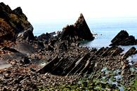
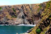
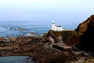
We pointed the campervan north and headed for the Hartland peninsula, one of my favourite coastal areas. We stayed at the pleasant Stoke Barton Farm campsite which was about a mile from the coast close to Hartland Quay where there is a fine pub. Pic 36 says I think that we were lost, sunset from Stoke Barton Farm, Culm coast, rock folds from Hartland Quay. Pic 40, Speke's Mill waterfall. pic 41 Hartland Point lighthouse.
40-43
Last few days, we moved to Lynton and walked along the cliffs round Foreland point untill, dogged by exhaustion and mauled by ticks and pollen we cut across country into the delightful Watersmeet valley, dropped in at the very welcome NT cafe then and back to out site at Lyn Bridge.
Mexican Fleabanes were everywhere.,
Take me away from all this!
FAO John Middleton.
- Mangrove-leaved Daisy Bush Oliaria avicennifolia *
- Treasure Flower Gazania rigins *
- Balm Leaved Figwort Scrophularia scrodonia *
- Orange Birdsfoot Ornithopus pinnatus *
- Red Corn Lily Ixia campanulata *
- Blue Corn Lily Aristea ecklonii *
- Fleshy Yellow Sorrel Oxalis rubrocincta *
- Wire Vine Muehlenbeckia axillaris *
- Karo Pittosporum crassifolium *
- Pastel de Risco Aeonium tabuliforme *
- Giant Herb Robert Geranium maderense *
- Tree Bedstraw Coprosna repens *
- Shore Dock Rumex rupestris *
- Giant Echium Echium pininana
- Subterranean Clover Trifolium subterraneanum
- Rough Clover Trifolium scabrum
- Western CloverTrifolium occidentale
- Rosy Garlic Allium roseum
- Chilean Iris Libertia formosa
- Small Flowered Catchfly Silene gallica
- Yellow Centaury Cicendia filiformis
- Green-winged orchid Anacamptis morio
- Fringed Rupturewort Herniaria ciliolata
* Identified on The Scillies
TRIALS, TRAVELS & TRIBULATIONS THROUGH CENTRAL TURKEY!
John & Valerie Middleton
INTRODUCTION.
The panic began when Yasemin, our Turkish botanical guide from 2022, had to drop out of our 2023 excursion due to family reasons. This was barely four weeks before our departure. What to do? Abort, or attempt the 23-day trip alone? With some trepidation, we eventually chose the latter!
Four weeks does sound like a long period, but we can assure any reader that it is not long when dealing with a foreign country! It involved changing our itinerary, hiring a car for a 3,000km one way trip, re-booking and changing much of our accommodation, doing cash transfers, obtaining latitude and longitude references for the plant sites and much more. On the plus side we could add other places of potential interest to our itinerary and stay for longer or shorter periods. So, the die was cast.
Following several restless nights and the usual Manchester Airport chaos we eventually arrived at our accommodation in the small town of Uchisar on the edge of Central Cappadocia. Here, we were warmly welcomed, and put at ease, by Emel. Stage one achieved!
For the next few days, Emel became our ever-patient survival mentor and good friend. Each day became filled with adventure and surprising highlights – some samples follow.
1-5 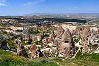
001. Uchisar – Cappadocia. This view of the classic ‘Fairy Chimneys’ was one within 50m of Kale Konak, our small Hotel. This, in turn, was also part built into the Cappadocian rock just beneath Uchisar Castle.
The accepted area of Cappadocia is approximately 250km2. It is a region formed from volcanic ash and lava flows dating back to 60,000,000 BP. The principal volcanoes were Erciyes Dagi (3,971m), Hasan Dagi (3,268m) and Melendiz Dagi (2,963m). Various smaller cones continued erupting up to 10,000,000 BP.
The current spectacular landscape has been formed simply by continued wind and water erosion through the ages. The ‘caps’ to be found on many conical Fairy Chimneys are due to a harder level of volcanic rock being the final upper layer (usually ignimbrite). The local peoples who then moved into this area found that the lower layers were a much softer rock that could be easily hewn into habitable caves. Some chose to burrow downwards forming underground cities capable of holding hundreds of inhabitants (Derinkuyu, Kaymakli and more).
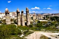
002. Love Valley – Cappadocia. Without doubt, our favourite area with an amazing variety of formations. It has a total length of 4.9km most of which is easy walking. Towards the top end, from Uchisar, it is possible to walk on the valley edge for even more amazing panoramic views and the occasional café.
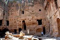
003. Gumusler – Nigde. This is an impressive Underground Monastery on the northern outskirts of Nigde that dates to the 10th century. It is famous for the many well-preserved religious frescoes that adorn its innermost rooms. The paintings were produced around the same period. The outer cliff face continues down the hillside where there are many smaller habitable caves. These were possibly used by the monks.
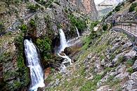
004. Karpuzbasi Selaleleri – Nigde. The site of six pristine waterfalls spouting from this cliff face is undoubtably one of Turkeys Greatest Natural Wonders. It is remote, it is wild, and it requires ‘nerves of steel’ to follow the narrow winding road down the ever-spectacular Zamanti River Gorge. Surprisingly, by the last waterfall there is an unexpected café and slightly further still, an immaculate Public Toilet. This is modern Turkey!
Karpuzbasi is situated at the south-eastern end of the Aladaglar Massif. This great block of limestone covers an area of over 800km2 with a relief extending between 400m and 3,750m. Over 150 caves are known so far, the deepest being Kuzgun which reaches -1,429m with a surveyed length of 3,187m. It is thought that the waters from Kuzgen resurge at Karpuzbasi. The highest cave entrance so far recorded is found at 3,410m. There is a further large outpouring of water from Goksu Cave in the Zamanti River Gorge. Unfortunately, whilst the cave passage is of considerable size the river siphons after only 100m.
The western side of the massif also has many small caves and a very large canyon which is the easiest way of entry onto the upper surface. This is also a popular area for rock climbing.
**With thanks to Alexander Klimchouk et al for the statistics mentioned above.
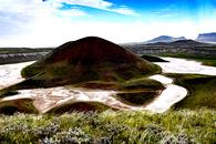
005. Meke – Karapiner. This small, but spectacular volcanic crater, is situated just 6km from Karapinar and close to the main road to Eregli. It was originally formed around 5,000,000 BP. Just 9,000 years ago a further volcanic eruption formed the 50m high central island. The total crater size is 800m by 500m and the salty water is up to 10m deep. There are also many other fascinating volcanic features within the immediate vicinity.
6-10 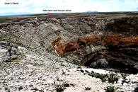
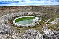

006. Cirali Obruk – Karapiner. Despite their great size, obruks are still difficult to find on the generally flat Konya plain. However, this one did have a small signpost pointing the way. But once there, we were literally ‘blown away’ to find not one but 3!! The first was ‘Yilani’, well over 100m deep and 300m across; almost by its side was a much shallower bowl shaped obruk 100m across and perhaps 20m deep with no name; and finally, the amazing Cirali obruk, 150m deep, over 400m wide and with a shallow lake in the bottom. Additionally, a considerable number of rock houses and stores had been hewn out above some precipitous ledges.
Obruks are large collapse sinkholes in a low limestone plateau within the Konya Basin of central Turkey. There are numerous old obruks, in various states of degradation, and 21 that have formed within the last 40 years. They appear to have hypogenic origins*, with the new obruks induced by drainage changes. - Tony Waltham. Cave & Karst Science, Vol.42. No.3, (2015).
* Hypogene – formed at depth.
007. Meyil Obruk - Karapiner. This was the furthermost obruk from Karapiner that we managed to reach on a full and fascinating day. It was a fitting climax. Almost a kilometre across, 100m deep and a 250m wide lake in the bottom. Traditional old homes and farm buildings nearby added further interest. A site never to be missed.
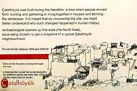
008. Catalhoyuk – Karapiner. Catalhoyuk is reputed to be one of the most important archaeological sites ever uncovered. It dates to the Neolithic Period some 9,000 years ago and has probably revealed more information on this period and peoples than any other discovery. Recognition is noted on the United Nations ‘World Heritage List’.
It is situated about 25km south of Karapiner and fully justifies an afternoon’s deviation. This extensive site has only recently opened to the public and is a model of understandable signage. Entry is currently free. See the website for more details - https://www.catalhoyuk.com/book/export/html/54
009. Mevlana Museum – Konya. Born in the 13th century, Mevlana Celaddin-I Rumi was to become one of the world’s greatest poets, mystic, teacher and disciple of Sufism and the Whirling Dervishes. This magnificent museum/mausoleum is where he was laid to rest at the side of his father. It is an essential ‘must see’ for anyone passing through Konya. In 1958 Pope John XX111 wrote: “In the name of the Catholic World, I bow with respect before the memory of Rumi”.
Come, come again, whoever you are, come!
Heathen, fire worshiper or idolatrous, come!
Come, even if you broke your penitence a hundred times, come!
Ours is the portal of hope, come as you are!
For anyone with an interest in Mevlana and Sufism start by reading ‘The Forty Rules of Love’ by Elif Shafak – Penguin Books. This is fiction but is based on solid fact covering the lives of both Rumi and Shams.
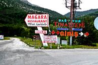
010. Tinaztepe Sign – Akseki. Just one sign of many that occurred along the roadside up to 50km before reaching Tinaztepe Cave. It may seem a strange photo to put in an article, but this is nothing compared to my shock and surprise when we first spotted it!
11-15 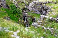
On a caving expedition to Turkey during 1967 three of us made a bumpy 5km 4x4 trek across the barren Tinaztepe limestone plateau. At its end we were shown an unexplored cave which we descended to a depth of around 100m. Here, we ran out of equipment at the top of a vertical drop down which we could see a large passageway. French cavers later returned and over several years extended the system to almost 20km.
There is now a major highway passing within 200m of the cave together with a petrol station, restaurant, and a Show Cave which visits the upper dry passageways. The once rough and barren plateau is now replaced by a vast forest! Progress or…??
011. Tinaztepe Cave – Akseki. This is the entrance streamway that we originally descended. The dry cave passages for visitors are behind us set in an impressive cliff face.
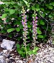
012. Rose Helleborine – Akseki. As with 2022 our key plant species for 2023 were Fritillaria, Iris and Tulip. Unfortunately, due to the very late season we only managed to find 2 Iris species and none of the others. In compensation we did come across various orchids as we dropped down from the higher mountains. Cephalanthere kurdica or Rose helleborine was one of our favorites which grew in considerable quantity in light woodlands. In this case it was both found in an ancient unfenced, ghost-like, cemetery and its surroundings to the east of Akseki.
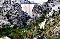
013. Oymapinar Barrage – Manavgat. In 1966 we were invited by Dr Temucin Aygen to join French Cavers in the Manavgat River region of Southern Turkey. The object was to explore the area for caves where there was a proposal for a major Dam to be built. We were incredibly successful with many kilometres of unexplored caves being discovered and surveyed. This included several in the narrow gorge where the Dam Wall now stands. The most famous was ‘Dumanli’, then the largest, and wildest resurgence in the Middle East.
The Dumanli resurgence was situated almost at river level in the steep sided gorge that now has the 185m high ‘Oymapinar Barrage’ at its entrance. A steeply winding road by the Dam wall allows visitors to pass through a tunnel to a viewing area and continuing road that overlooks the deep lake beyond. Exploration of Dumanli was written up as ‘The Siege of Dumanli’ in the YRC Journal for 1968.
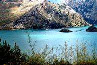
014. Oymapinar Lake – Manavgat. Tourist Show Boats and small Launches now sadly float above the many drowned caves and passageways that we had once so excitedly explored. No comment! The Dam wall is just off the picture to the left.
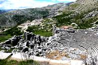
015. Sagalassos – Aglasun. A fitting climax to our last day. Another amazing archaeological site! Sagalassos is claimed to be one of the best-preserved ancient cities in the Mediterranean region. It is situated on a wide terrace at an altitude between1,450m and 1,700m just 7 winding kilometers from the old town of Aglasun. It has been settled by ‘Hunter-gatherers’ since 11,000 BP. Following rule by many local ‘chieftains’, the region has also suffered many occupiers including the Persians, Alexander the Great, Seleucids, Attalids, Romans, Isaurians, and Seljuk’s.
An earthquake in the 13th century caused the abandonment of the city and the area was allowed to become overgrown. It was re-found in 1985, when an Anglo-Belgium team of archaeologists instituted a survey of the site. Investigations are still ongoing, but parts are now fully open to the public.
Postscript. There may not appear to be too many ‘tribulations’ in the above notes, but there was one major one for us every single day in simply driving to where we wished to go. There are no road rules!!! Speed is essential; overtaking on either side is accepted; U turns may be done anywhere; traffic lights are normally ignored, and police radar traps usually have long queues of apprehended law breakers whilst more race by. Surprisingly we did not see any accidents!
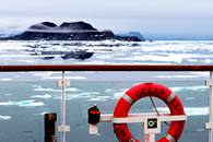
Svalbard, July 23 - August 3rd.
We were originally going to go to Australia for a couple of months, but in the end red tape and complications got in the way and we gave up and opted for the next best thing, a two week trip around the islands of Svalbard with Aurora Expeditions. Not quite as scorchy as Australia, in fact the archipelego lies well north of the Arctic circle.
As ever, initiallising these trips can be wearisome, not least all the paperwork. Insurance, medical details, passports, booking flights and hotels, disclaimers in case you get eaten, and you name it, we were asked for it. Eventually we flew from rain soaked Manchester to Oslo but we had to make our own way there and arrange ourselves some overnight acommodation. Fortunately, the rather smart Radison Blue airport hotel turned out to be within easy walking distance of the Luggage reclaim. I recall it was about 1.00am next day before we checked in.
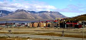
So, next day we caught the SAS plane from Oslo to Longyearbyen, the only settlement of any size on the islands, about a 2.5 hour flight. Once again we had to stay overnight at another rather smart chalet hotel. Longyearbyen has a population of around 2400, main industries are coal mining (1) and tourism. The houses were brightly coloured rather like other arctic towns that we have visited. However, there are strict rules regarding which colour you can use on your house. In the afternoon we were zodiac-ed to the trusty Ocean Explorer and allowed to settle in before receiving our free thermal jackets and returnable furry muck boots.
Weather? Dry and mainly sunny, temperature as high as 15C in Longyearbyen but usually 8-10C. In the far north we dipped down to 1C.
1-4
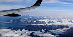
- Flying into Longyearbyen
- Longyearbyen
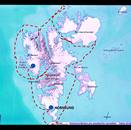
- Our eventual route around the Svalbard archipeligo
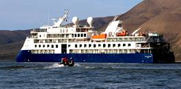
- The Ocean Explorer. Room for 130 passengers but with all the singles we numbered just 103.
Good Morning good morning, our wake up call. Next day they took us across Eisfjord to Skansbukta, probably as a kind of test run, to check that we could actually climb in and out of the zodiacs. We seemed to pass the test, some better than others. Before we were allowed to land however, scouts would go ashore first to check that there were no polar bears. Even then, we were accompanied by men with high powered rifles and bear scarers. Apparently, getting eaten is really bad PR for the company. Pleasant landing in a dramatic setting, sprinkled with wild flowers.
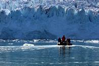
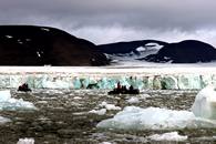
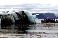
Overnight, the ship set off with intent and next morning we found ourselves in the far wild and remote north of the islands, almost within spitting distance of the North Pole. We were taken out on a zodiac trip found the snouts of the Monacobreen and Seligenbreen glaciers which were calving large lumps of ice into the sea.
5-10
- 5. Skansbukta
- 6. Skansbukta and old boat
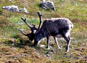
- 7. Reindeer
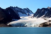
- 8. Seligenbreen Glacier
- 9. Monacobreen Glacier
- 10. Ice and islands drifted past.
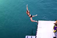
The captain seemed to have a secret desire to reach the North Pole but eventually failed when a huge barrier of sea ice defeated us and the ship ground to a crunching halt. However, we reached just a touch under 80°N. About this time a strange madness overtook some of the passengers, and they took off their clothes and leapt into the water at 1°C for the Polar Plunge. Doctor on standby.
11-14
- 11. Ladies first
- 12. And second
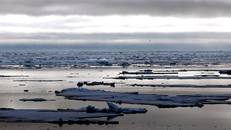
- 13. Looking North towards the pole.
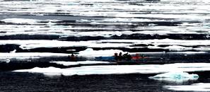
- 14. Kayackers amnongs the floes and a broken down zodiac.
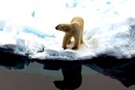
There was a certain obsession amongs some of the passengers with regard to Polar Bears. The faintest white dot on the horizon would result in an outbreak of very long lenses and a tendancy for the ship to develop a list in the bear's direction as ursaphiles crowded onto one side of the observation platform. Eventually we had some close views of them and the novelty started to wear off. This one is probably a young male but without flipping it over and looking at its naughty bits we couldn't be sure. Once bears were sighted we were not allowed to go ashore and we lost a couple of landings because of them
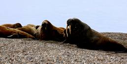
We also saw quite a few walruss. These can be detecten from over 1km away by their smell.
15-17
- 15. Polar Bear 1
- 16. Polar Bear 2
- 17. Walruss colony.
Plan A was to sail along the coast of the most easterly island, Nordaustlandet but the sea ice was hard packed against the land so we resorted to plan B which was to visit an area called Texas Bar. However, we woke up to thick fog and were transferred to plan C which was bird colony and walruss spotting.
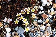
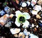
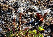
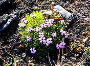
Even in this hostile region there were lots of tiny wild flowers. Sue spent much of her time ashore on her hands and knees with her camera.
18-22
- 18. Tufted Saxifrage Saxifraga cespitosa.
- 19. Svalbard Poppy Pappaver dahlianum.
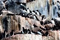
- 20. Brunnich's Guillemot colony, there were tens of thousands of these birds.
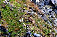
- 21. Arctic Fox, gull for lunch.
- 22. Sue.
After the birds we set off through a narrow channel called Heleysundet which is only navigable at certain states of the tide and looked a bit like the Straits of Corrievrecken at the North end of Jura. Overnight we set off south and rounded the most southern cape of Sorkapp Land and woke (good morning good morning) to find ourselves in the ice choked fjord of Hornsund. We took a zodiac cruise along the snouts of the Hornbreen and Storbreen glaciers. Very spectacular with lots of icebergs.
After this, we dropped in below the huge limestone outcrop of Gnalodden and pottered up and down the shore.
23-27
- 23. Hornbreen glacier.
- 24. Icebergs.
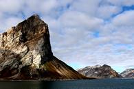
- 25. The huge limestone butress of Gnalodden. Great looking climbing rock if only it wasn't covered with thousands of birds.
- 26. Alpine Bistort Bistorta vivipara
- 27. Moss Campion Silene acaulis.
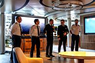
- 28. At the Captains farewell cocktail party. Captain (3rd) and officers.
28. 
So that was it. Next morning from our window there was Longyearbyen again, just a walkway away. Airport to Tromso, off the plane and on again with our luggage as there were no customs and security facilities on the island. Then Oslo, overnight again and back to jolly old Manchester airport where it was drizzling.
Brilliant trip. Many thanks to Aurora Expeditions who really looked after us and fed and watered us a little too well. Can't fault them, go for it.
Chris and Sue.
Nelsons Monument on Birchen Edge
Mike Browell May 2023 (mike.browell@btinternet.com)
Something to share with the Grumpies
When we were younger we all did some daft things.
But one of the Grumpies did something so daft it caused the Nelson Monument on Birchen Edge to be substantially re-engineered, after 150 years of service.
The monument sits on top of the crag, close to the Three Ships. This area is known to climbers as Monument Buttress. Graham Hoeys’ guidebook ‘Peak District Gritstone’ shows a photo of Orpheus Wall HVS 5c, above which stands the Nelson Monument. In fact 14 metres above the start of the route.
Classicists will remember that Orpheus descended into the Underworld.
When first erected the monument was flat topped. A very small flat top, no more than 6 inches square.
From the early 1900s climbers came along looking for rocks to climb. By the 1970s there were 124 climbs recorded on Birchen Edge, mostly with nautical names. The guidebook also states:-
“The monument is climbable and people have stood on their heads on its summit.”
Circa 1965 our bold and fearless esteemed Grumpy Dave Lockwood aged 19 (and three- quarters) scaled the 3 metre stone pillar, solo, unroped, in primitive PAs, and teetered into a standing position with the prospect of either a 3 metre drop or a 17 metre drop, (a possible re-enactment of the fatal descent of Orpheus into the Underworld). He then put his hands in his pockets for this picture to be taken. And climbed back down; you don’t jump 3 metres onto a flat gritstone landing if you can help it!
Dave reckons the ascent was 6c, and 6c+ if you are cool enough to put your hands in your pockets for the summit photo.


Postscript
Grumpies do have long memories! Gerry Langsley has told me that the original 1810 Nelson Monument did have a ‘cannonball’ topper, a link to the Three Ships nearby which were well endowed with cannons.
Barry Platts history in the 1985 Derwent Gritstone guide states:- At the closing of the 1930s decade, The Sheffield Climbing Club had produced many of todays favourites. As a finale in 1939 a large stone ball capping the monument was trundled by vandals.
Those ‘Vandals’ must have had some climbing skills!
For younger members reading this I should explain that the noble art of Trundling was causing large immobile rocks to break free of their long held static location, and proceed rapidly downhill hopefully without hitting anything valuable. Nowadays that would not be PC!
Mike Browell
CAMINO de SANTIAGO
11 – 20 September 2023 by Mike Browell
Itinerary
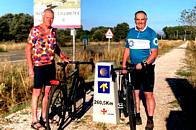
Stuart Gascoyne and I set off on a six day road bike ride from Leon to Santiago de Compostela. This would be the last half of the 800 km Camino Frances which starts from Saint Jean Pied de Porte in southwest France. Each day would cover between 55 – 75km, some 3 – 4 hours of cycling.
Stuart and I have done many other long distance bike rides, including several Etape de Tours, the last of which was 180km in 2016. We declared that was definitely the last as we struggled to leave the conveniently sited bar at the top of the final climb.
The Camino was planned as a much more leisurely undertaking.
However, Stuart had the bit between his teeth and set off much earlier on a three day reccy. He misunderstood the various signs for ‘footpath’ and ‘bike trail’ and so cycled the scary footpath and even fell off his bike a bit!
There are at least eight Caminos, and the scallop shell motif symbolizes the caminos converging on Santiago de Compostela. These routes have captured the hearts and minds of travelers for centuries, and millions of people have made at least one of the journeys. They are a fundamental element of the economy of all the places passed through, and the travelers are friendly, determined and welcomed by their hosts.
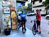
We hired bikes which were delivered to our hotel in Leon. This hotel was hidden within an historic monastery close to the cathedral of San Isadoro, and on the route of the Camino, in a pedestrian precinct. We were to suffer several more pedestrian city centre precincts, all unsuited to cars.
1-4 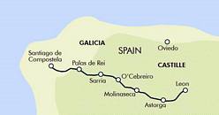

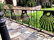
- 1. Map of our route
- 2. Monastery Hotel Leon
- 3. Scallop Shell motif railings
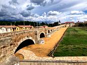
- 4. Hospital del Orbigo bridge
Apart for changing the hire bike flat pedals to clip-in eggbeaters we were ready to go the next morning. Linda very kindly drove the support car which involved very scary ancient city driving on medieval roads better suited to donkeys. The donkeys on this trip used bikes.
The early morning Camino foot traffic began around dawn at 7am. Around 1000 people are on each stage of the Camino every day, and they all start and finish at roughly the same time. Because we were covering more distance we came across waves of walkers every few hours.
I found the city navigating too tricky without a paper map, so on our first morning Linda took me to the edge of Leon to join Stuart on the tarmac N 120 road which would take us to Astorga.
We lost the tarmac road within minutes as Stuart spotted Camino scallop shell waymarkers on walls, signs, painted on footpaths, and so led us through various gravel paths, quarries, drainage tunnels and housing estates. Half an hour later and we were still on the outskirts of Leon. We then stuck to tarmac and ignored the myriad of Camino markers.
The Camino follows the main roads for most of the way, on parallel gravel tracks which are very well signed. The walkers have to cross the tarmac road frequently, and have a casual attitude to risk of collisions. Perhaps they are dreaming of Higher Things?
Highlight of the first day was the multi-arched medieval bridge crossing the flood prone Rio Orbigo in Hospital del Orbigo. This is the longest pilgrimage bridge in Spain and unlikely to be flooded as it has at least 14 arches.
The day finished in the walled city of Astorga where in 1889 a young Catalan architect Antoni Gaudi designed a buildable Episcopal Palace for his friend the Bishop. It only took 24 years to build, unlike Gaudis’ earlier masterpiece, the incomplete Barcelona Sagrada Familia Cathedral which began in 1882 and still remains incomplete. He didn’t know the technology needed to build it, and that is still true today. Before his death he said:- "My client (God) is not in a hurry."
5-8 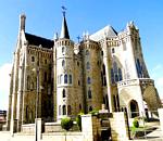

- Astorga Episcopal palace
- 6. Typical road and gravel parallel Camino
- 7. Monte de la Cruz de Ferro
- 8. Pedestrian zone in Molinaseca
Second day took us into the mountains and a very long climb to the Monte de la Cruz de Ferro 1,505m. The iron cross stands on a huge mound, formed over the centuries by millions of pilgrims each bringing a stone from their home and casting it over their shoulders, symbolically casting their cares away, and continuing with their journey. The altitude and the endless zigzags up to the highest point on the Camino is energy zapping; it is higher than Ben Nevis. On the summit we met two South Africans wearing ‘Cape Town Cycle Race’ jerseys so naturally we shared a beer or two.
A non-pedalling descent of 15 km took us down to Molinaseca. Stuart did pedal but he was racing one of the South African Cape Argus riders (he won).
Molinaseca is a small village with very small streets and a baffling no-entry system. It took a while to find our small hotel perched at one end of the pedestrian river bridge, perfect for pilgrims on foot, but unsuited to law-abiding cyclists.
9-11 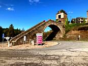


- Portomarin staircase
- 10. Cathedral altar & incense ball
- 11. Happy pilgrims.
As we set off the next morning we came across a young cyclist in distress. Most cyclists we met were young except those on electric bikes. This chap was trying to fix a puncture and making a bit off a mess about it. Sturt pitched in, threw his punctured inner tube into a bin and used one of our spares to get him on his way in minutes.
The third day took us deep into the valleys and wooded mountains and the foothills of O’Cebreiro. We stopped in Ruitelan, a valley bottom village that has been by-passed by normal roads, and where the motorway passes high above on a series of flyovers. The valley bottom villages would not be there without the Camino traffic.
The 9km long climb out of Ruitelan to the mountain top village of O’Cebriero was the hardest of the whole ride, some of it very steep. A long descent took us into Sarria in Galicia, and a perplexing search for our accommodation which turned out to be on the Camino but in another car-free pedestrian zone.
Sarria to Palas de Rei was the second to last day with a huge 13km climb followed by a 12km descent.
The crossing of the River Minho is by a modern replacement of a much lower Roman bridge, and many walkers find the view over the bridge quite vertiginous and intimidating, particularly when the water level is low. The river is actually Minho Reservoir and its width comes and goes; for us in September it was quite narrow so I kept my eyes closed. The rowing club ramps were stranded high and dry. This famous arched bridge at the end has a steep flight of steps but the cycle route avoids it to begin the 13km climb.
The final day of 75km into Santiago was quite easy until we tried to reach our hotel near the cathedral by car. The ‘No Entry’ signs indicated that residents could enter but there was no health warning about the narrow squeeze-gap constriction which has for centuries removed sheets of paint from passing carts and cars. We did several passes of the pedestrian precinct of the cathedral by car and by foot.
The next morning we joined thousands of Camino pilgrims and wondered at their commitment to make one of the longest mass participation walks in the world. For most it would have been a four week journey. The Cathedral was packed as always and the incense ball was firmly belayed and not swinging expensively. The external spaces around the cathedral are possibly even more impressive than the interior: it was designed to astonish from a distance.
My spiritual advisor, Adey Hubbard sent me this snippet:-
“They are now restricting the incense swinging to specific saints' days because it costs 400 Euros a pop to do it. If a particular pilgrimage requests a "performance" and coughs up the dosh they will also get swinging at the 7.30 am Eucharist, complete with choir and heavenly voices etc. Individuals can make the same request, if they pay the full whack. Seems reasonable, Frankincense is expensive and they have to pay the eight pot swingers (so to speak) for their services as well. Clearly, getting god on your side has suffered the same inflationary pressures as everything else! The next advertised session is not until 1st November, so to coincide with a special request is very much pot luck. The cathedral remains a must see though, swinging incense or not. “
12-13 

- Stuart with his InCredibility t-shirt
- 13. Santiago de Compostela Cathedral
FOOTNOTE
I bought two Guidebooks to the Camino de Santiago, one for cycling and the other for walking. Both were less useful than a chocolate teacup. The cycling guide had clearly been translated from Spanish by a linguist who couldn’t translate ‘senda’. As most of the book is about tarmac roads or gravel paths this was a fairly major oversight.
The only useful element of the cycling guide were the maps, and these failed to deliver continuity.
The Gravelings in historic Greece.
Following in (some of) the steps of Heracles - Climbing and Greek mythology around the Peloponnese.
I have to blame Stephen Fry as, having read his “Mythos” trilogy, I started to feel that I knew all the Greek gods personally and just had to see their home turf. So, as we were obliged to return via Athens from this autumn’s trip to Kalymnos, what better than to extend it, drive to the Peloponnese and combine a mix of climbing with visits to some of the iconic (sorry Tony Mays!) ancient sites and, in particular, some of those where Heracles had performed his Twelve Labours.
Jane, Keith and John were “co-opted” into my plan which entailed tagging on an extra 10 days to climb at a selection of easy access, easy grade crags on the Peloponnese (aka “the Not Leonidio Trip” as many of the Leonidio crags have quite steep, loose access paths – not good for arthritic knees!). Having fixed upon the crags, a pattern emerged relating to Greek mythology – we could actually take in the sites of three of the Twelve Labours of Heracles and, also, a few other places relating to the Trojan War. Thus prepared, John & I and Keith & Jane embarked on our own Odyssey……
Grumpy Alert Warning – slight hiccup at the very start of the trip when we discovered that, the car rental company we had booked with, had a maximum driver age limit of 75 – no exceptions!! As a result, John was demoted (grumpily) to Navigator for the whole trip!
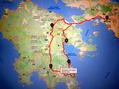
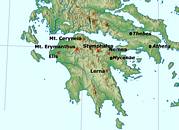
MAP OF ROUTE
B - Naphlio. C - Leonidio. D - Kyparissi. E - Sparta. F - Stymphalia/Kalliani
A brief description now follows of our climbing and cultural journey in case this is of any future interest to fellow Grumps.
Climbing
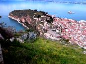
Nafplio - This is a straight forward 2.1/2 hr or so drive from the airport. We went to the Anatoli crag - nice reliable crag around the back of the town with super views over the bay and only 1 minutes walk from the car. Good range of single pitch medium grade routes.
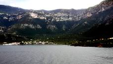
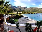
Kyparissi – by-passing a surprisingly busy Leonidio, we then followed a very tortuous road over the mountains to reach the coast at Fokianou, from where we took the new coast road to Kyparissi. Kyparissi is a very small, very quiet, beautiful seaside village trapped within a massive horseshoe of very impressive crags. Lots of climbing there – and bags of further potential - but mostly too hard for us mortals! So, bad weather and lack of ability restricted our climbing to the two easiest crags - Kastraki (in the village itself) and Playground. Enjoyable climbing but, we felt that, unless you are the A-Team, not worth making a specific journey from Leonidio just to climb there. The bad weather- 2 days out of 4 – highlighted Kyparissi’s limitations as, apart from climbing, there is little else to do
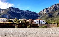
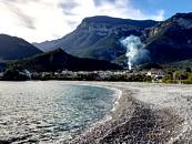
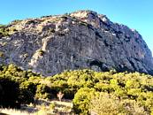
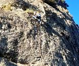
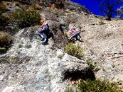
Stymphalia/Kalliani - Frygani crag. A very long drive, from Kyparissi to our accommodation base in the village of Kalliani, took us through some amazing scenery both at the start and at the finish of the journey. Frygani is great - a big conglomerate crag with lots of routes – both single and multi-pitch. Although we only climbed at Frygani, we also looked at nearby crags - Astra ( N facing and cold because of the altitude) and Mylos (mostly too hard). We also discovered that there are more small crags in the area that we didn’t have time to visit, but which could warrant further investigation in the future.
Sponsorship of routes
In the case of both Kyparissi and Frygani, the bolting has been funded by a local cooperative effort in an attempt to draw in more climbers to the area and hence, more revenue. Whilst this works very much in the climbers’ interests by the provision of nice new well equipped routes, whether the shops and restaurants feel there has been sufficient return is debateable ? Local interests not helped either by the fact that the Chris Craggs of Greek climbing, Aris T, has produced a competing guide book.
And now the cultural bit :-
Labours of Heracles
Map showing the sites of some of the “Peloponnese Labours”
Tyryns We Looked at the outside of Tyryns - the remains of the ancient palace of Eurystheus - who was responsible for burdening Heracles with the 12 Labours - and to where Heracles returned following the completion of each task.
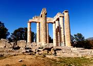
Nemea – Ancient Site of “Olympic type Games “ and where the Nemean Games are still held in the original, full size stadium. Keith and John re-enacted one of the races for the camera, but, as the athletes traditionally ran totally naked, these photos have not been included for fear of upsetting our more sensitive readers. Nemea is important as it is the place where Heracles accomplished his 1st task – slaying the Nemean Lion – and, thereafter, acquired his trademark look – lionskin cloak and lion teeth jewellery (as per photos).
Lerna - Located just outside Naphlio on the road south to Leonidio. This used to be a large malodorous swamp and an entrance to the Underworld. This is where Heracles carried out his 2nd task – slaying the many-headed Hydra. As the Hydra grew two heads for every one chopped off, Heracles enlisted the help of his Nephew, Iolaus, to cauterise the cuts to prevent more heads from growing.
Stymphalia – The lake of Stymphalia, which is wet in winter, but dry in summer is the site of Heracles’s 6th task – to rid the lake of its infestation of man-eating birds. He did this with the help of the goddess Athena, by producing a giant rattle to scare them away.
Trojan War
Nafplio. Our first stop was Nafplio, ancient capital of the Argolid, which is dominated by the Palamedes castle. Palamedes recruited Odysseus on behalf of Agamemnon to join the Greek army in the Trojan War.
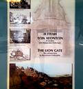
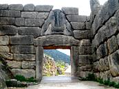
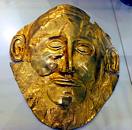
Mycenae – thought to be the ancient palace of Agamemnon, leader of the Greek Army in the Trojan War and brother of Menelaus , King of Sparta. Home of the famous gold death mask, originally thought to be that of Agamemnon himself….but now thought probably not!! Wishful thinking on the part of the notorious tomb raider, Heinrich Schliemann.
Menelaon, nr Sparta. Great position but now not much more than a pile of stones on a promontory, overlooking the Spartan plain. This was built as a tribute to Menelaus and his wife, Helen ( yes – she of 1000 ships) and could have been the site of their palace from where Helen was originally abducted by Paris - the event that is said to have started the Trojan war.

Too much culture can make you go quite dizzy. However it's time for festive silliness with the Fiendish Grumpies Pictorial Quiz, for which, as ever, there will be a prestigious bottle-shaped prize. As last year, the quiz will be on-line and will be released late Sunday 10th December, when, like a flock of malevolent bats the questions will decend upon the soft white underbelly of Grumpyland. All will be revealed at the party on the 15th December.
This will give you 4 or 5 days to mull over the answers. Send them to me at chrisandsue59@gmail.com answers and prize will be given at the party. It's a bit more climb oriented this time. Are there any climbers out there?
Even if you only know a couple, please join in and have a go and email your answers to me if only to show that my efforts were worthwhile.
Click to enlarge.
1. Identify the route. Yes, that's Jim Ballard.  Great Corner, Willersley
2. Identify the buttress on the left. 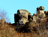
3. Identify the route.  The Count, Stanage
4. That's your webmaster. Identify the route. Armageddoin, Stoney Middleton
5. Identify the route.  Triton, Moat Buttress WCJ
6. Where are we? Name the estuary. 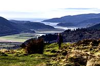 The Mawddach estuary.
7. Which mountain?. 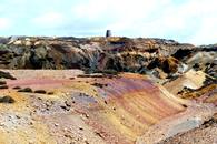
8. Name the pub. No rude suggestions please.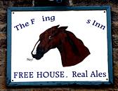 The Flying Childers, Stanton in Peak.
9. Where are we? 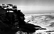 Kinder North Edge or possibly Fairbrook Naze.
10. Where are we?
11. Where is this Peak District cave.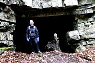
12. Where are Roy and Bill Wintrip?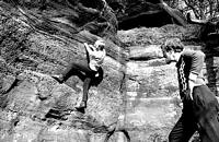 The Churnet Valley
13. Who dat?.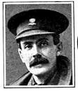 Geoffrey Winthrop Young.
14. Identify the route.  Highlight, High Tor
15. Name the popular gristone climb below this cross. Compact binoculars for scale. Sunset Slab, Froggatt
16. Name the nearby village.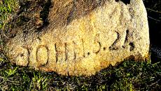 Curbar. Side of road below Curbar Gap.
17. Who dat?  O.G.Jones
18. Yes, that's Bill Wintrip. Identify the route.  Wuthering, Stanage.
19. Identify the river. 
20. Identify this popular gritstone route.  Fern Hill, Cratcliffe Tor.
So there's your answers for this year.
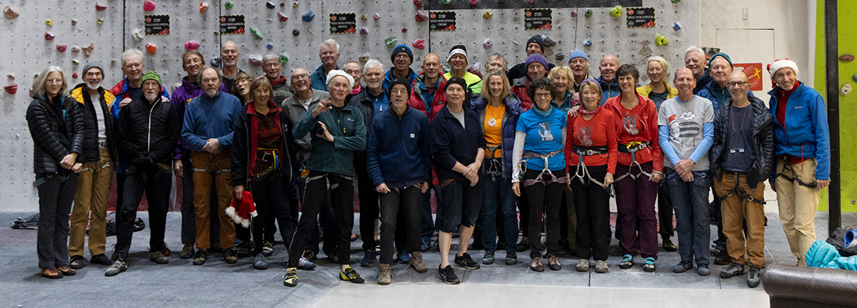
Group shot at Awesome Walls pre-party. It should be mentioned that Awesome Walls generously gave us £50 towards the party. Thanks guys.
Click on images to enlarge.

- At the wall.
- Elaine has been good all year. A likely story.
- At the party
- John presents his last year award for GOTY
- Cath makes a case for Adey as GOTY 23
- Me with Graham Parkes clutching his quiz prize.
Quiz Prize Graham Parkes and Helen with 16/20.
Man-Booby prize to John Middleton for his article on Turkey.
GOTY goes to Adey Hubbard in absentia.
Should anyone want a larger hi-def picture of the group shot please let me know.
Christmas Day Christmas Crack
As all venerable Grumpies will know, there is a traditional ascent of Christmas Crack on Stanage on Christmas Day, This is usually organised by Dick Turnbull and co-conspiritors John Jones and Gordom MacNair. A good turn out this year and absences were generally of the family commitment type. So here goes, a few action photos from Adey Hubbard, Grump of the Year 2023 and winner of the headless climber award. (I just made that up)
Click to enlarge.


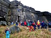
So, Happy or Grumpy New Year to everyone. See you in 2024,
Chris
Now onward goes, along a narrow path
Between the torments and the city wall,
My Master, and I follow at his back.
Dante.
Chris Jackson email

