Grumpy Old Men's Climbing Club 2022
March | May | June | July | August | Oct | Nov | Quiz | Party
AWAKEN Grumpies!
Though it hast not yet been emptied, the bottom of our kibble chalice is once again visible

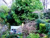
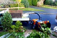
February. So, what is happening in Grumpydom? Some are now managing to get away. Roy and Marilyn have been away skiing and come back with Covid, Darrell and Amanda have been away climbing and come back with damaged hands and several others have been trickling away to destinations abroad. What have the Jacksons been up to? well, not a lot, I suppose the highlight of this year was the removal of the forest giant Laurel at the end of our garden. A brief spell of wet snow followed by strong winds caused three giant branches the break, doing terrible damage to Sue's raspberry patch and almost demolishing next door's garden shed. We had to call in 'the men' with their jolly woodsmen's songs and their chain saws.
Those of you on social media may have seen some of these before.
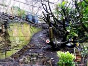
- The men survey the jpb
- Chips away
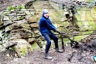
- The root of all evil.
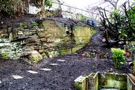
- The newly exposed uppper garden with crag. Spot my amazing drystone retaining walls and steps.
- Stump art, work in progress.
We did however get away for a day, the Yorkshire Sculpture Park to be precise, which is near Wakefield. Only £6 to get in, seemed like a bargain until we ventured into the cafe where they clawed many more £s off us.
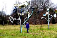
Some of the sculptures were thought provoking, others pretentious rubbish. See 4.
- Rabbit woman with split personality
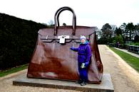
- Sue's new handbag
- By Henry Moore
- Someone's taking the piss.
- Virgin Mother by Damien Hirst. Similar to Verity at Ilfracombe.
Today, like many others, it's raining. Forecast? More rain. Grrrump.
Next project, our very overgrown shrubbery which may be a 12 month project. Watch this space.
New old from Griff.
I have attached a couple of old photos, which may be of interest.
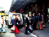

1. The notorious 1975 ACG trip to climb with the GHM. Team comprised Jack Street, Al Wright, Speedy Smith, Paul Nunn, Ken Jones, Rod Valentine and yours truly. Picture of team being picked up by the French taken outside Gare du Nord. Ask Jack about the fracas on the train from Calais to Paris and how we demolished the French contingent with numerous bottles of duty free Talisker. The climbing was good as well.
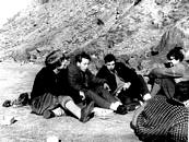
2. Alpha and SUMC dossing in the Grochan Fields in 1963: Mike Richardson, Clive Rowlands, Al Parker, Mike White and Chris Trotter. Radio was probably playing “Island of Dreams” by the Sprindfields – remember them? (Oh yes, Ed.)
3. Another pic of Al Wright climbing on Gogarth probably in the early 80’s. Note the PA’s, Whillans harness and set of Hexes that I acquired on a trip to the States in 1978.
Griff.
Guess the Ethel from Stuart Gascoyne
Inspired by Clare Baldings Ramblings programme on Radio 4 I have decided to bag the Ethel’s see.https://en.m.wikipedia.org/wiki/List_of_Ethels
There is also an app called Ethel Ready which you can use to record your conquests. The biggest objective danger is probably being chased by an angry landowner for those involving a trespass.
In this weeks programme Clare launched her expedition to ascend to her first Ethel of Stanage Pole from the Redmires car park accompanied by 2 ex fell runners. Impressive stuff.
The 2 pictures are of the Ethel ascents that I did this weekend.
Click to enlarge.
Your challenge should you choose to accept it is to identify them.
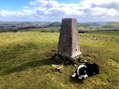
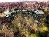
A clue for the one with the grouse butt is that it involves a lot of bushwhacking which must have been one of the challenges faced by Benny Rothman when he and his chums pioneered the well trodden paths that will take you to many of the other Ethel’s
May 6th. The times they are a'changing. In view of the lack of a Grumpy Christmas parties over the last two years, Roy and Marilyn are kindly hosting a late Christmas do at their house, Small Hall, on Friday May 6th PM. If you intend to attend, please could you let them know so that they can arrange catering.
Tragically, Sue and I willl be away on holiday but dispair ye not for here is a slightly shorter Fiendish Pictorial Quiz, slightly more fieldish than last year as there were too many high scores. John Jones, MOC will be in charge and awarding the prize so let him know your answers or bring them along and hand them in. Or something. Roy will have a televised display of the pics for any late entries.
No Man-Booby prize this year so I will be hanging on to it.
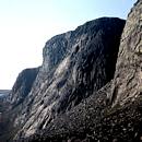


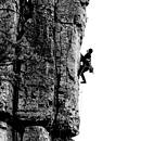
- Name this Scottish crag.Creag an Dubh-loch, Cairngorms
- Name this climber, walker and author. E A Baker
- Name this climber and author J W Puttrell
- Climbing with Tom Proctor. Where are we? Saint Bees, Cumbria
- What climb is Roy failing on? Tippler Direct, E3 6a
- Name this Peak District climb. Lucy Simmons, Stoney Middleton, E2 5c


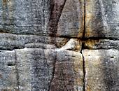


- Identify this classic route. Mecury, Carn Gowla, Cornwall. Direct E2 5c.
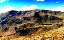
- Name the hill, summit on left. The Old Man of Coniston.
- Where are we climbing? Portland.
- Name the route. Rusty Crack, HVS 5c, Stanage
- Which Peak District village is the home of this young lady. Great Hucklow.
- Name this Peak District pub. The Barrel Inn, Hucklow Edge.
Bon Chance. Bottle shaped prize for the winner.
The Winner with 6 correct entries, despite protestations of it being too climber orientated was Tom Westgate. I trust that there was no Googling going on.
Well done Tom.
June 5th. God save the Queen and all who sail in her. Apart from that, Bill and Alison Wintrip have sent us some stunning photos of there holiday along the Juliana trail in Slovenia.
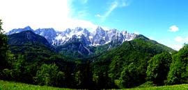
Alison and I went to Slovenia a couple of weeks ago and did the Juliana Trail. This is a 267km long circular trail around the Julian Alps. The trail leads through valleys, over mountain passes, forests, through urban and rural areas and goes along the Soca, Sava, Baca and Tolminka rivers. It even pops into Italy for a day. The highest Slovenian peak, Triglav, is seen several times on the walk.
The walk took us a couple of weeks, we did it the easy way, where our suitcases went ahead of us each day, meaning we only needed to carry a day pack. We stayed in some great accommodation ranging from 4 star hotels to apartments and B&B’s. We only met 6 other walkers during the whole trip and that was an Austrian group going the other way!
The Slovenian countryside is beautiful. It may not have the grandeur of the Alps or Dollies but it has it’s own charm. There are several excursions on the walk to gorges and waterfalls that are well worth doing. The people are very friendly and English is spoken in most areas. We booked the self guided trip through a Slovenian company called Helia, who are based at Lake Bled. They really looked after us. They booked the hotels, sorted the suitcases and arranged airport transfers etc. The company also organises cycling tours, which along with kayaking are the other popular sports in the region. There is also rock climbing.
Another thing worth mentioning is that the section of the walk that is near the border with Italy was heavily involved in the First World War eastern front fighting. There are walks and museums dedicated to this time in world history.
1-6 

7-11 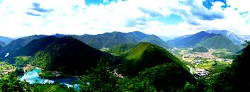
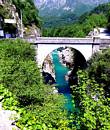

12-16 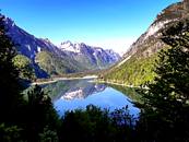
Photos:-
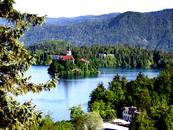
- Lake Bled from our hotel balcony.
- The famous Bled cream cake – a must! Much ‘lighter’ than it looks – honest! (A likely story, Ed.)
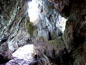
- The route goes through this cave in the Pokljuka Gorge.
- Juliana Trail signage. This varied from this type of sign to yellow ‘JA’ markings on trees and rocks, to sod all in Italy! We used GPS maps throughout the trip.
- Descent from Baska col. There is a 1st World War gun emplacement in the rock above Alison.
- Typical forest trail.
- Views of the towns of Most (left) and Tolmin. We had a rest day in Tolmin. A visit to the Tolminska Korita Gorge is worth it.
- The Napolean bridge over the Soca just before the town of Kobarid (great museum).
- the beautiful waters of the Soca.
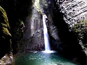
- Kozjak waterfall.
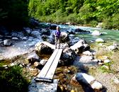
- A bridge along the Soca.
- Mt. Svinjak, just outside the town of Bovec.
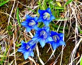
- Lots of flowery things on the trail!, (Gentians actually, Ed.)
- View from the Predel pass into Italy.
- Cinque Punte on the way to our stop in Tarvisio in Italy.
- The pointy one is Spik (2473m).
SOME BOTANICAL ADVENTURES IN EASTERN TURKEY. May 2022.
The far eastern region of Turkey is very much a wilderness area of untamed, snow-capped mountains, great gorges, and ancient cities. It also has borders with Georgia, Armenia, Iran and Iraq. Our interest was mainly botanical and, in particular, the bulbous flora for which the area is famous. To this end we had managed to hire as our guide Yasemin Konuralp, the author of a standard reference work on these kinds of plants.
Our first evening meal together was at a typical Turkish restaurant in Trabzon. Yasemin and her husband, Cemil, lived in Antalya, a place that we knew well having both climbed and caved in the region, a good start. The conversation became even livelier when we mentioned that during 1966 and 1967, we had spent 10 weeks exploring the local, then unknown, caves. Our trips were joint ones with the Speleo Club de Paris under the invitation of a Dr Temucin Aygen of Ankara. Then, in an amazing coincidence, not only were Yasemin and Cemil lifelong friends of Temucin, but they also knew many of our fellow French caving friends. We could not fail to have a fantastic time after that meal and we did, every single day!
THE PICTURES.
1-5
6-9 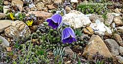
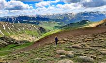
10-13
14-18
19-22
23-25
1. Zigana Pass and area. This was our first botanising site situated at a rather exhausting 2,000m – exhausting, that is, after life at sea level and a heavy meal the previous evening.
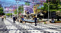
2. Trabzon. Our arrival city. It is a busy eastern Black Sea resort that had put out the ‘welcome flags’ for our arrival! Actually, the flags were for the local Football Club that had just won Turkey’s National Championship. The city centre is a very clean and friendly place with lots of seats and even clean, free, public toilets! It was also the only city anywhere that had a store whose sole product for sale was ‘Halva’ – a mouth-watering delicacy much favoured by John. We liked Trabzon!
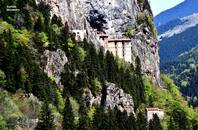
3. The invincible Sumela Monastery. This outstanding site is found high in the Altindere valley some 40 minutes’ drive from Trabzon. It dates to AD386 but did not reach its present form until the 13th century. Frescoes were painted on many of the cave and building walls in the early 18th century. Restoration is currently being undertaken.
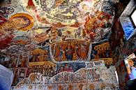
4. Just a few of the many impressive Frescoes covering the Monastery walls and ceilings.
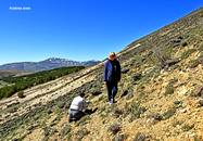
5. Hillside botanising in the Kostrea hills, always steep, but always worthwhile. Yasemin and Valerie.
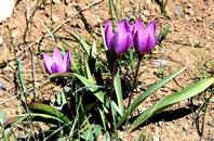
6.The ever-beautiful Pulsatilla violaceae found in quantity by the Kop Pass Relay masts at an altitude of 2,470m. As with many of the best finds the plants were near the edges of newly melting snow.
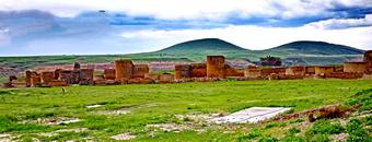
7. The Walls of ancient Ani. A walk around these crumbling walls extends for over 6km. It is situated on the Armenian border and was once known as the ‘City of a thousand and one Churches’. This is an obvious exaggeration as the number is thought to have been just sixty! The city was founded in the 5th century and reached its peak in the 10th. The site was abandoned by AD1735 after first being destroyed by Genghis Khan and then again made uninhabitable after two earthquakes. The building in the centre is the partially renovated old Cathedral.
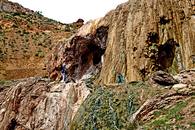
8. The little-known warm water travertine cascades of the Kotek Valley. It occurs in two substantial drops totalling almost 50m.
9. More successful high-altitude plant hunting in the Tahir area (2,200m). This is a place where we were first tracked by a military helicopter and then questioned by four armed Gendarmes in a substantial 4x4! Interestingly the conversation was more about the deep mud where their vehicle became stuck whilst trying to reach us, and how did we managed to navigate the obstacle.
It is probably worth mentioning that for much of our meanderings we were within 50km of an international border and sometimes as close as 200m. It was, therefor, no surprise that the armed Police, Gendarmes and Military should regularly accost us. All these incidents passed by very politely. As always, they were looking out for illegal migrants, terrorists, and spies.
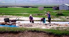
10. Murder Most Foul! Not really…...just the friendly local ladies doing the villager’s weekly clothes wash. Those were the days!
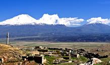
11. Mount Ararat is 5,137m in height whilst the beautifully shaped Little Ararat is 3,925m. The last eruption was in 1840 when the black lava flows in the photo were formed. Yasemin and Cemil, our super-fit guide and driver have both summitted this mountain five times. For ‘Grumpies’ interest, the remnants of Noah’s Ark (?) are in an Information Building on the hill opposite Little Ararat.
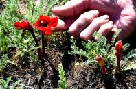
12 Phelypaea coccinea. A stunning but rare plant, parasitic on the genus Psephellus (the cornflower family). It was found in a field beside the Bendamahi River.
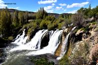
13. The Bendamahi Falls situated close to the town of Muradiye. Only 12m high but an impressive flow over travertine. This is as far as the fish in Photo 14 can reach.
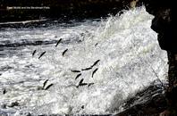
14. Pearl Mullet leaping the Bendamahi Cascades to spawn in the gravel riverbed before the much larger Bendamahi Falls. It also seemed to be a popular place for Wedding Ceremonies and local picnics.
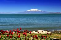
15. Lake Van from Van City with Suphan Dag volcano, 4,058m, on the opposite shore. This is a slightly saline endorheic lake covering 3,755 m². It is up to 110m deep and at an elevation of 1,640m. The Pearl Mullet (Pic. 14) is the only fish capable of living in the salty water.
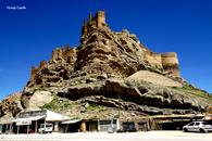
16. Hosap Castle. An impressive and strategically well sited Kurdish fort that was built in 1643 at the time of the Ottoman Empire. There are several similar castles in the region. Additionally, before reaching Hosap, the Urartian citadel of Cavustepe, dating back to BC735, resides on a passing hilltop. An interesting historical area.
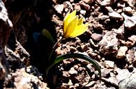
17 Tulipa koyumcui. This very beautiful tulip survives at 2,600m on the windswept Guzeldere Pass. The hillside is one of the few places where it is known to grow. Unfortunately, ‘conservation’ is a little understood term within Turkey. Apparently, the week before our arrival a minibus stopped at this site with its passengers alighting and digging up the plants, presumably to sell. Ours was the only tulip that we could find, hidden in a small crevice!
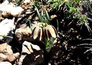
18. Fritillaria crassifolia subsp. kurdica. Another rare plant found slightly higher up the same hillside. These plants were probably saved from the ‘diggers’ by their size and camouflaged colourings.
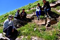
19. When you cannot find what you are looking for then ask the local children. We showed them a picture of a Fritillaria we were searching for, and they knew exactly where the plants grew. This was halfway up a mountainside, and this is Yasemin giving them a lecture on conservation in return!
20. Tulipa humilis. We came across several hundred plants of this beautiful species which also appears in an equally stunning magenta colour. The site had just escaped an extensive road widening scheme. With the tulips were also pale blue Pushkinia and more Fritillaria.
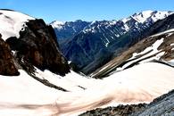
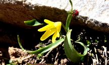
21. Karabit Pass, 2,985m. Yes, this is a botanical site and probably one of the most exciting that we came across. The small road comes up the valley and enters a 3-400m long tunnel around the snow. An amazing array of plants are to be found at the lower snow melting point including the dainty yellow Fritillaria minima in picture 22.
22. Fritillaria minima. Just 8cm high.
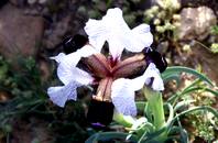
23. Iris paradoxa. One of the ten different, and equally magnificent Iris that we came across. Paradoxa was one of many on a sloping meadow above Lake Van. The flower head measured around 15cm across!
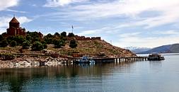
24. Akdamar Island, situated to the southern side of Lake Van, can be reached by a fifteen-minute boat ride. Apart from it being an attractive haven away from bustling Van City, it is home to a 9th century Armenian Cathedral and Monastery. Both places were in use up until 1915 (a notable period for local massacres!). There are many reasonable murals within the small Church.
Back at the small port from where the boats leave, it is possible to sample freshly caught Pearl Mullet in one of the several small cafes. The fish is certainly tasty, but bone removal skills are definitely required!
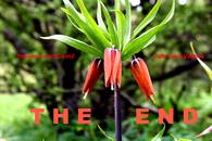
25. Fritillaria imperialis. Undoubtably the ‘King’ of all Fritillarias growing to well over a metre high. Only a few sites remain for this plant as it has been over-picked by the locals and over-collected for bulb sales. Our site was on a steep hillside, above an old graveyard, to the south-west of Lake Van. The few remaining plants were, surprisingly, protected by the local villagers who insisted on keeping any driver’s licence until they left (empty handed, of course!!).
Our Grand Tally for new key species on the trip was 5 Tulips, 9 Iris and 11 Fritillarias. Plus, a host of others. And two new friends. Highly satisfactory!
Chris and Sue. June 14th to July 10th. Well, I don't think that we can compete with that, but here is a snapshot, nae, a vignette of our trip to central and South Wales.
Rhaeadr. We hadn't been there for quite a while, in fact our last visit might take us back to our pre-campervan days when we quite happily slept in the back of our estate car. How did we get it all in? Life was simpler back then. We started off at the small town of Rhaeadr, staying at one of the CCC club sites close to the town centre. Very nice too. On a bright and sunny morning we set off full of optimism, having totally forgotten our experiences with rarely used Welsh footpaths and were soon experiencing an action replay. Eventually, it all resolved its self, but only just. The Cambrian mountains proved to be a desolate area, and though they don't sport many craggy bits there are huge areas of uninhabited uplands.
Rhaeadr is close to the Elan Valley reservoirs. The dams, reservoirs and 73 mile aqueduct of the Elan Valley were built a hundred years ago to supply desperately needed clean water to Birmingham, an epic feat of civil engineering set within an area of outstanding scenic beauty. However, they weren't quite as impressive as they might have been, as they were half empty. On following days we completed some more long walks, suffering only minor bramble wounds and nettle stings.
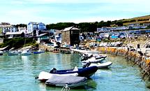
New Quay. We moved on to the CCC Cardigan Bay site about 2 miles South of New Quay. We spent a day exploring the pretty (and touristy) town before getting to grips with some coastal walking next day. Using public transport we rode a bus to Aberporth and took to the coast path. The start proved to be a bit overpopulated with large static caravan sites, but once we passed the pretty inlet and beach at Tresaith things took a turn for the better. The scenery was stunning, much like the best bits of the SW Coast path. Huge cliffs and sea stacks littered the view as we trekked on past Llangrannog which I vaguely remember being taken to on a family holiday back in the 50s. It didn't look to have changed much which must only be good. The path eventually traversed a long steep hillside which dropped straight into the sea and had danger warnings. Excited and encouraged, we pressed on regardless. As the campsite was South of New Quay, we took to a wooded valley in order to cut the corner off. Tricky as ever, nearly 16 miles and over 1000m of ascent. Phew!
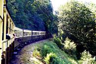
It was time for a bit of touristing so we bussed it to Aberystwiyth and took a trip on the Veil of Rheidol narrow gauge steam railway to Devil's Bridge. All very jolly and there were some impressive waterfalls down the gorge below the bridge.
Back in New Quay, lured by the promise of dolphins we took a boat trip on a small twin hulled power boat. And did we see any? Yes. We encountered a pod of about 20 Bottle Nosed dolphins, adults, mothers and calves who seem only too happy to play around and under our boat. Very impressive but tricky to photograph.
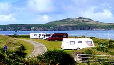
St Davids. For some inexplicable reason, Sue booked us into Rhosson Ganol, a campsite several miles from St. Davids, our intended destination. On the plus side it had stunning views across Ramsey Sound to Ramsey Island. It was also on route for the Celtic Clipper minibus which for a couple of quid would take us into St Davids (and other places along the coast). The down side was that we were miles from St Davids, Kate the SatNav was having one of her funny do's, she was convinced that a private dirt track was a minor road, and the ablution block was about a quarter of a mile from our pitch. Smart ablutions but why no hooks or baskets in the showers?
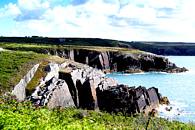
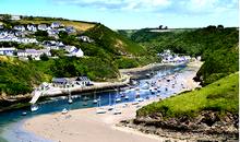
We walked along the coast to the pretty port of Solva, passing some areas of climbing rock, and a lot of sea stacks, returning via local transport and the Celtic Clipper. Overnight, something happened to the weather and next day we hunkered down amid squally showers, making serious inroads into my Kindle reader and the Cryptic Crossword book.
Next day we took the bus to Porthgain, an interesting village with an equally interesting history of granite quarrying. It also housed the legendary Sloop Inn and some ancient brick built rock silos. Steady walking back, past the famous Blue Lagoon, 12 1/2 miles in just under 7 hours. Including lunch stop, icecream and Ramsey Island ferry booking with Thousand Islands Adventure.
The ferry to Ramsey Island ran from the lifeboat station almost next to our campsite, and we were allowed 4 hours on the island before the return crossing. Brilliant little place with some amazing coastal scenery particularly on the South tip of the island. We also completed the Ramsey Island Three Peaks Challenge in about 2 hours. There's no stopping us. We were so impressed that we booked a further trip. a circumnavigation which took about 1 1/2 hours. There's some amazing cliffs on the island which also sports the second highest sea cliff in Wales at 130m (second to Gogarth?) and a lot of sea birds, mainly Razorbills and Guillemots. I don't think that the RSPB likes climbers.
Rhandirmwyn Where? You may ask, well, it's in the middle of nowhere about 10 miles north of Llandovery. A CCC site in an idyllic setting.
Making sure that we had the latest OS 25000 map, we set off on what appeared to be a long but easy to follow circuit on bridleways, which would touch the wall of the Llyn Brianne reservoir on its way round. Easy to follow circuit, well, maybe 100 years ago but not now. From the campsite we followed easy tracks up the Cynnant valley as far as a deserted farmhouse of Cynnant. From here things went seriously pear-shaped. The path dwindled to a vague line through bracken fields and we reached a point in the forest where our bridleway should split left. Despite us being spot-on with the GPS there was nothing but conifers. We fought our way up to a forestry track, the GPS indicated straight up but the was almost impossible due to steep banks, new plantings and barriers of sharp sticks.
We headed into a narrow valley, wrongly assuming that there must contain some sort of path. No, just tussocks and a necessity to cross and recross an annoying stream. We regained the GPS position, not a sign of a bridleway, and followed its green line across a gorge and up a barrier of 45 degree bilberries. Eventually we topped out into a wilderness of newly planted Christmas trees along with lots of holes and more barriers of prickly sticks. Exhausted, we reached a boundary fence. Nice sheep cropped grass beyond? No. Huge tussocks with water-filled holes.
Eventually we spotted a road way below us. Sue started burbling and we stumbled onto an old quarry track, so apart from another 4 miles we were saved. Total 14 miles and 8 hours. The lady in our campsite said that the bridleway over Mynydd Mallaen on the West site of our campsite was reportedly also un-navigable. I have recently purchased a new set of Adventure maps from my GPS company SatMap. Neither of the bridleways are marked. Come on OS!
We did several more excellent walks in the area none of which turned into epics.
Ludlow. Really just a stopping-off place to break the journey home, but we did spend 3 nights there. Ludlow turned out to be a lovely town with an impressive ruined castle overlooking the river Teme. Apart from exploring the town we did a couple of pleasant walks to the West, much of which was in the Mortimer forest area.
Home, the house not burgled or burned to the ground. That was a memorable holiday.
1-6 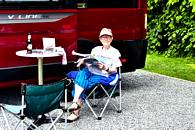

- Home sweet home
- New Quay
- In the gorge below Devil's Bridge
- Vale of Reidol railway
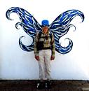
- Sue gets her wings in Aberaearon
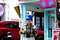
- The doggy ice cream has more bite.
1-5 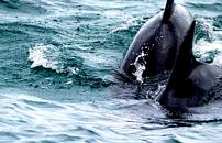
- Bottle nosed dolphins near New Quay
- Sea cliffs near Porth Clais
- Solva
- Rhosson Ganol campsite, Ramsey island in background
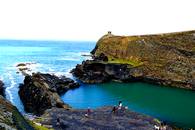
- The Blue Lagoon near Porthclais.
1-5 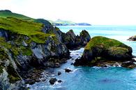
- On the coast near St. Davids
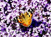
- Tortoiseshell butterfly on Thyme.
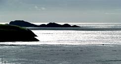
- From the campsite. Ramsey island and Bishops and Clerks.
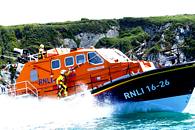
- Lifeboat launch.
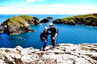
- Us on the southern tip of Ramsey Island
1-5 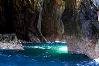
- Mysterious cave, Ramsey island.
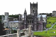
- St. Davids cathedral.
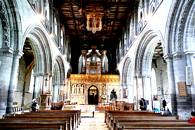
- Inside St. Davids cathedral
- The last civilization in the Cynnant valley.
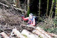
- Barracades of sharp sticks.
1-5 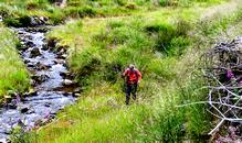

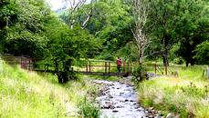
- Tussocks and an annoying stream
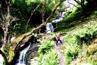
- Carmarthenshire's highest waterfall near Rhandirmwyn
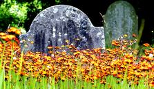
- Fox and Cubs in Cilycwm churchyard
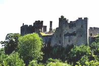
- Ludlow castle
- Queen of the castle.
1,2 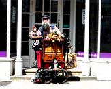
- In Ludlow
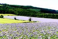
- Fields of Phacelia near Ludlow. Mortimer woods behind.
August 20th and it's Mike Browell's 70th birthday party, not that Mike is a member of our elite Grumpies climbing club as he claims that he is never grumpy, but many of us were there to help him celebrate. It was a splendid do, with champagne, unlimitrd booze, an Indian Curry and a lot of excellent company, including a few faces that I haven't seen for quite a few years.
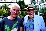
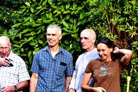
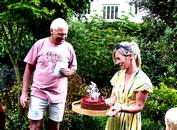
- That's me, and Roy looking very dapper.
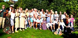
- Party members, less Mike and Margery Mortimer who turned up later.
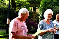
- Mike reads out his history, overseen by Linda.
- Mike Waters, Keith Sharples, Graham Hoey and Helen.
- Mike's 70th birthday cake arrives.
Well done Mike and Linda, that was a generous and memorable party, and we were all home and tucked up in bed by 10.00 pm as befits our venerable status..
Once again, webmaster and wife have been away, getting themselves into trouble as usual. Here is a vignette of our last trip, which took us North of the border (mainly). 4th September to 30th September.
1-6
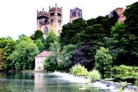
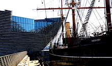
- Durham Cathedral
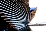
- The V&A in Dundee
- Scott's ship the 'Discovery'.
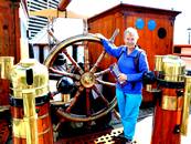
- Sue discovers the steering wheel.
- There's lots of that up here.
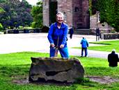
- But she had high hopes, she had high hopes, high apple pie in the sky hopes. Sue, failed, Scone Palace.
We started off in Durham which I know is not actually in Scotland but we felt in need of a bit of culture. Durham Cathedral was very impressive both outside and inside. The old town was pleasant, but the castle had been given over to student acommodation so apart from the cathedral there was not a lot else. The campsite was a little less impressive, it was 2 miles outside of Durham next to the motorway so very noisy, facilities were up to usual CAM standards but two night would have been enough.
We pressed on North, stopping overnight at the pleasant little CCC site at Jedborough which has a ruined abbey, all very nice except that it was part closed due to health and safety and falling masonry. We called in at the Mary Queen of Scott's museum in the village and were so engrossed that we found ourselves locked in, in the dark with the security alarm ringing in our ears. The kind warden eventually let us out.
Scone (pron scoon) next, just a couple of miles from Perth, famous for its Fair Maid and the river Tay which was quite high, and notorious for its bridge disaster. . We pottered around the town and on the way back to the campsite we visited Scone Palace. Very ornate but rather expensive at £16.50 pp. Great Maze in the gardens though, we got genuinely lost in this. Next day we caught the train from Perth to Dundee and visited the V&A museum which was sort of OK, but Scott's Discovery next to it was a lot more interesting. Amazing building though.
7-11
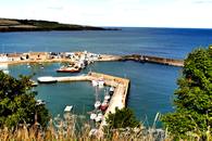
- Stonehaven harbour.
- Not many people know that.
- Detail of a series of beautiful stainless steel sculptures along the sea front.
- Dunnottar castle
- Stonehaven.
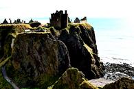
Onwards North and Eastwards to the CAM site which was almost in the centre of Stonehaven, but at £33 per night for members it needed to offer something special. It turned out to be a pleasant little town with an attractive harbour. The closest attraction was Dunnottar castle, and quite rightly so, it was rather impressive. A few miles down the coast is Fowlsheugh nature reserve near the tiny village of Crawton where there were no birds. On the map there looked to be an obvious 3 miles along the cliff top to the well-trodden footpaths around Dunnottar castle, and as the RSPB claimed to have maintained 2 miles of clifftop waliking, the connection looked easy. Not exactly. The RSPB 2 miles turned out to be nearer half a mile, and the obvious connection was anything but. A narrow footpath started us off but this eventually got narrower and less well-defind until it eventually crumbled over the 150 foot conglomerate cliffs. We managed to cross a series of rusty barbed wire fences to gain a line of stubble fields, which led, not easily I might add to the Dunnottar footpaths. Never a dull moment and all my fault of course.
12-16
- Sue at the Lower Falls of Foyers.
- General Wade's bridge at Whitebridge.
- On route to a failed attempt on Beinn Fhada.
- Scottish scene
- The EMC hut in Gleann Lichd.
West now, next stop Loch Ness at the CCC Foyers site on the shore of the loch. Nice site though we were unsure why the toilets got Loo of the Year, they were clean enough but nothing exceptional. The walking around Loch Ness turned out to be limited. There was the South Loch Ness trail, some of which we followed and was more undulationg than we expected, and there was The Falls of Foyers, nice setting but due to the lack of rain were a bit underwhelming.
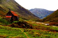
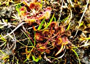
We moved on to the CAM site at Morvich which is at the bottom of Glen Shiel. Good site and amazing position amongst some big hills. In uncertain weather we made a bid for Beinn Fhada by attacking it from Gleann Choinneachain and were making steady headway when the view disappeared and it started raining. Assailed by a strange whining noise in my ears, we turned around and headed back down the valley. Grrr! Next day we pottered up Gleann Lichd as far as the EMC hut. Easy day out for a lady, 10 miles of pleasant track and there were sundews.
17-21
- Insectiverous Sundew in Gleann Lichd
- Beinn na Caillich near Broadford, Skye.
- Sue is revolting on Beinn na Cailich.
- Blabheinn, when we were younger and Sue was a climber we traversed this.
- By Loch Slapin
Skye now, and we are camped at Skye Camping, the excellent community centre site at Broadford. Hard to fault and seemingly overlooked by Beinn na Cailich, a Red Cuillin sort of peak. We decided to walk to the start of the ascent from the campsite, which turned out to bad decision No.1 as it was almost 2 miles. We referred to the Cicerone guide Walking the Isle of Skye by Terry Marsh. Bad decision No.2 as his vague and misleadind description of the start led us onto the boulder studded flanks of the mountain. Loose boulders and tussocks prevailed and eventually Sue mutinied and refused to ascend any further. Probably for the best, as in 2 hours we'd made little impression on the hill. Later reference to Google revealed that it was classed as Very Difficult and Scrambly. Terry seemed to have reversed an earlier route without revising the approach.
On our retreat across the hillside we stumbled upon a slight footpath, at least someone had been here before!
But Terry's descriptions were not all bad, and we followed an excellent circuit from Kilchrist Church past the ruined clearances at Suisnish and Boreraig. All very sad, how could they do this to people?
22-26
- Along the coast to Boreraig.
- Sue amid The Clearances
- In an effort to support the local economy we bought some Broadford Gin.
- The Fairy Pools and the dreaded Waterpipe Gully.
- The wonderfull positioned campsite at Kinloch near Dunvegan. Spot our camper.
The Fairy pools? Don't do it, for although they are pleasant they are not exceptional and they are an example of commercialism gone mad. £8 to park and walk along an eroded muddy footpath along with hundreds of other people. No!
- Macleod's Maidens, Idrigil Point.
- The Black Cuillin, early morning on our return.
Macleod's Maidens, a group of sea stacks off Idrigil Point and an essential tick. We took the camper to the little farm at Orbost where there was loads of parking provided and set off down an easy track which soon deteriorated into a very muddy footpath. No matter, we made it and there they were. Next day, off home. Moffatt stopover 260 miles.
Could this be an 11th hour bid for the coveted Man-Booby prize? Adey has sent in an extensive pictorial account and article of his and Jan's 2022 exploits (Awesome wall excluded). So here goes.
Adey and Jan go South.
1-4 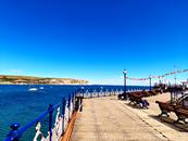


What to do when your body still doesn’t make it up proper hills and your better half wants to go to the seaside? Obviously, one compromises. So it was that, at the beginning of July, a car with caravan plus two set off for a week in East Dorset for some sea (tick) followed by another in the Cotswolds for some small hills (tick).
After a leisurely set up at Hunter’s Moon site near Wareham, we drove to Corfe Castle and boarded a steam train bound for Swanage. It was getting warmer by the second, so we took a short stroll to the pier (Pic 1) to look across to Old Harry Rocks, followed by an ice cream and another short stroll up the western ridge and round the sticky-out bit. There we found that Hutton’s Unconformity might well be in northwest Arran but there is another one at the end of the sticky-out bit (Pic 2). Further exciting adventures included Kingston Lacey house (Pic 3), dating from 1663 for the current mansion and built for Sir Ralph Banks after his very own Corfe Castle was shot to bits during the Civil War, followed by another stroll out to the Badbury Rings (Pic 4). This is a massive Iron Age hill fort of three concentric ditches encircled by 15 metre embankments. In the centre are the post holes of the original wooden buildings and the remains of four Bronze Age barrows.
5-10 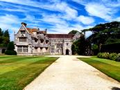
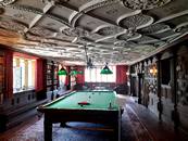
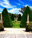
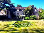
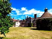

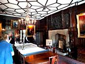
The weather was getting hotter by the day so we forsook small hills for cooler historic house interiors. The best was Athelhampton House (Pics 5 – 9), which is mentioned in the Domesday Book. The present building hails from 1485 (the Great Hall) with mainly Tudor additions and alterations. If you had £7.5 million burning a hole in your pocket, you could have purchased it in 2019. We were beaten to it by an English national Swiss banker from London who, apparently, had always wanted to live in a Tudor house. Well now he does, whilst maintaining the existing visiting arrangements through the National Trust which has not been able to confer its current penchant for wokery on the place. Definitely one of the best historic properties we have been to and a good 100C cooler than outside.
Feeling that we really should be showing a bit more enthusiasm for a walk we got up really early, when it was a mere 200C, and drove to Cerne Abbas to complete an 11km wander along the ridges either side of the giant. By the time we finished it was a tad warmer, at 36C, and there were no open cafes because it was a Monday. We had intended to do this round a year ago but were foiled by me failing to put either a map or a guidebook into the car. Wrong again. On the way home we felt that such exertions warranted some nice food, which we found at the Cock and Bottle Inn, in East Morden (Pic 10, for the gourmands among you).
(A 360C typo suggested that it was very hot. Ed.)
11-16 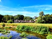
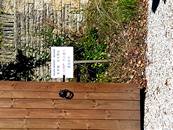



Time now to migrate north to Cirencester Caravan Club site. It turned out that the international air show at RAF Fairford was happening, as was the arrival of the hottest weekend of the year so far. A plan was hatched to see the formation flying whilst not paying lots of money for the privilege. We achieved this by driving to Bibury, where the star of the show is Arlington Row (Pic 11), and walking towards the high ground just north of Fairford. You would not want to live on Arlington Row! As the sign (Pic 12) shows, the coach loads of Far Eastern tourists need to be informed that private gardens are not there to be casually wandered around. Neither would moving-in be simple as many of the larger properties can only be accessed up quite a hill by a narrow, stony lane. You would not get a furniture van within 50 metres of this one (Pic 13)! Further on we came to a signpost (Pic 14). The place really does exist and is a tiny hamlet on a Roman Road between Cirencester and Coln St. Aldwyns, where a very welcome tea room provided yet more ice cream.
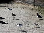
This stroll would have been lovely, had we not been actually melting, so we tried Slimbridge for the cooling breezes of the Severn. What we found was a hair dryer breeze coming up the river. The birds were hot, we were hot, the seating was hot; it was, in fact, hot. (Pic 15 shows some hot avocets with their mates and Pic 16 contains a hot crane, trying to keep cool amongst the plants across the water. It’s a rubbish image due to the shimmering heat and being at the extreme end of the zoom – but it was a crane and you don’t see them often in Dronfield).
After a week of hot we returned to Dronfield where it was ….. HOT.
Adey and Jan go North
1-5 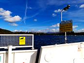
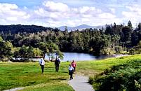

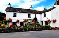
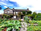
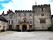
Now it is early September and we have headed to The Lakes and a site just past Kendal, where we lived when the boys were small. All established and still pretty warm we took a nostalgic trip across the Bowness ferry (Pic 1) to Tarn Hows (Pics 2 & 3), busy on a Sunday, and Near Sawrey. Next to a very floral cottage garden (Pic 4) we showed our cards and entered Hilltop (Pic 5), to find out about Beatrix Potter. When we lived there the boys were too young to appreciate the place, so we never went.
6-10 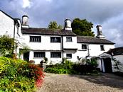

11-12 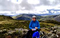
The following day the rains began so we took in Townend (Pic 6), at Troutbeck, and Sizergh castle (Pics 7 – 9), also firsts for us. Both were good but Sizergh was superb; highly recommended.Other highlights were meeting up again, after several years, with my climbing partner from 30 – odd years ago and a couple of trips to The Watermill at Ings. That’s where, on the way home from late work meetings, I began the establishment of a few additional pounds (stones?) around the midriff. Naturally, I’ve always blamed finishing up the kids’ meals that had already been paid for ……. but the truth is now out.
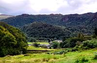
The next few days disappeared in a lot of water that was falling from the sky so, apart from the passing of Her Majesty, not much happened until the last day when, feeling in need of a proper walk, I took us into Borrowdale for a climb up to High Spy from Grange. It would have been better if we had gone up the real path, instead of the way more obvious sheep track that turned into vertical mud. Mrs. H. was most assuredly not impressed and accused me of going on courses to the Jackson School of route-finding; this despite the nice view back towards Grange (Pic 10).
However, the ridge was attained in time for lunch with the clouds clearing towards Dale head (Pic 11). Sadly, I had also forgotten that the way off via Cat Bells, softened only by the appearance of a herd (flock??) of llamas being walked up from Newlands (Pic 12), is quite steep and rocky in places. This did not go down well either, especially given that we were now too late for the Derwentwater launch back to Keswick and the advertised omnibus didn’t materialise. More views from the inside of a doghouse for your truly.
13-17 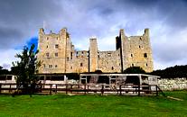
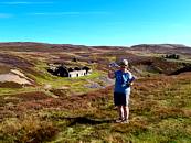
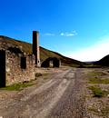
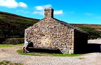

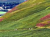
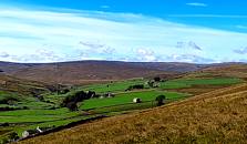
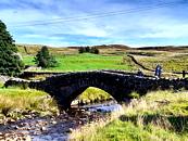
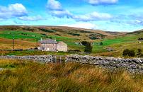
Somewhat chastened but with the promise of better weather to come we moved across to Swaledale and a brilliant little site by the river in Reeth, taking the opportunity to pop over to Castle Bolton (Pic 13), which I last visited in 1969. Thereafter the sun shone, as the shots of the valley above and below Surrender Bridge (Pics 14 – 17) show. We walked up past the Old Gang Smelting Mill ruins – mine adit included for the benefit of John Middleton, who particularly likes these things – for a circular trip over Brownsey Moor, where the full extent of the grouse shooting operations was very obvious.
18-21 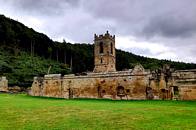
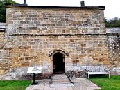
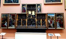
A slightly less sunny day took us to the well-preserved Mount Grace Priory (Pic 18), where we found out about the Carthusian monastic order. How does a seven-year novitiate, followed by a lifetime of near hermit, emerging from your cell only for three services per 24 hours and no communication with anyone, sound? Each monk had their own “house” containing a living space with work area, a praying space, a sleeping space, a covered privy and a small garden (Pic 19). In the photo, to the right of the door, you can see a small alcove. This allowed food and materials etc to be passed in and out but gave no means of visible communication. The toilet waste went through the high outer wall into a plumbed sewer and all the windows face inwards, to prevent visual contact of any kind. In search of less depressing things, and to have our eyes tested, we also drove to Barnard Castle and the Bowes Museum. This is now high on our list of really good museums and the highlight was definitely the altarpiece (Pic 20), painted by the Flemish artist known as Master of the View of Saint Gudule, a name to conjure with, we thought.
To round off a good fortnight, and with a beautiful day forecast, we finished with a great walk in Upper Swaledale (Pic 21).
22-25 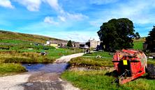

We started from Keld and took a route above Whitsundale Beck up to Ravenseat, where the tea van at the farm provided a welcome cream tea and views towards Tan Hill (Pics 22 - 24), followed by a return down the other side of the beck into Swaledale and the path on the north side of the river, with some pleasant waterfalls (Pic 25), back to Keld.
On the way home we stopped at Wetherby services and caught Covid. Bugger!
A brief account of our climbing experiences in NZ :-
FROGGATT EDGE - BUT NOT AS WE KNOW IT! from John Graveling.
When we mentioned to John Middleton (the man who appears to have been everywhere) that we had planned an extended trip through New Zealand, he revealed that he had been climbing there in 2010 and that one of the crags he had climbed at on the North Island was Froggatt Edge. As ex-denizens of Froggatt (of 30 years standing), a visit to the Edge in the course of our trip was a challenge we couldnt resist. John told us of a climbing shop, run by an expat called Bryce Martin, located only a mile away from the crag. A quick check on the internet confirmed that Bryce was still in business so that was the gear issue sorted - pack a pair of rock shoes and hire the rest from Bryce avoiding having to lump all the gear round New Zealand.
En route from Auckland to Rotorua, we decided to take a short detour to locate Bryce's shop and possibly the crag itself.
When we got there the shop was closed and no sign of Bruce - so that was a good start!
However, while there, we thought we might as well locate the crag and see what it looked like. The crag was easy to find and turned out to be an impressive stretch of rock, not massive but probably about 30 metres at its high point. The rock is volcanic ash - "ash" is a bit of a misnomer as the ash has solidified into very hard rock. The climbing features are pockets of various sizes and sharpness, and, lumpy excrescences again of varying size and sharpness. The rock is steep and the climbing pumpy. However, it's biggest attraction for us was that it was fully BOLTED!.
When we got to the crag, there was just one other climber there, who appeared to be top roping. We introduced ourselves to him and it turned out to be the man himself, Bryce, and that he was actually doing a new route not top roping. So being, I guess, in his mid-70s certainly wasn't holding him back. What didn't register at the time was his unusual approach gear - wellies and a waterproof!! We had a very pleasant chat and arranged to see him the following day and then continued to Rotorua.
The next day, a 90min drive saw us back at Bryce's shop getting kitted up with all the gear we needed - including a clip stick and stiffy.No sooner had we done this - at vast expense - then the heavens opened and it rained - torrentially (so that explained the wellies approach gear)!!
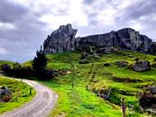
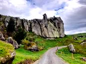

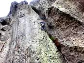

We then spent the next 2 hours sitting in the car, watching the rain and wondering how we might get a refund on all the money just paid out.However, fortune favoured us, it stopped raining and dried up sufficiently to get some climbing done. Bryce was there again, this time with his daughter, and, between us, we managed to have great afternoon - 5 routes done of which one was the 3rd ascent of the new route that Bryce had literally just completed ( graded some ludicrously high number in Ozzie terms but probably about 6a+/6b to us!).
What had initially looked like being an expensive waste of time had actually turned into a very enjoyable day and a great experience.
So here it is, the great 2022 Diabolical Pictorial Grumpy Quiz
Some are giveaways, others are, er.. diabolical.

.jpg)
.jpg)

Click to enlarge.
1-5 
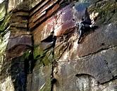

- Name this famous Scottish crag. Carn Dearg Buttress, Ben Nevis. Home of The Bat, Centurion and Sassonach and more.
- Where are Tom Proctor and I climbing? Stanton Moor Quarry
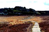
- Name this Peak District outcrop. Back Tor above the Upper Derwent Valley.
- Identify the route Twicker
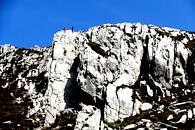
- Where are we climbing. Holyhead Mountain
6-10 


- 6. What dat? Clue: it's not a gravy boat. Bourdaloue, Named after 17C Jesuit priest infamous for his log sermons. The ladies used this (somehow).
- 7. Where is this famous rabbit with the split personality? Yorkshire Sculpture Park.
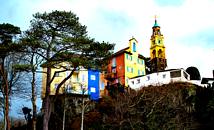
- 8. Where are we? Port Meirion.
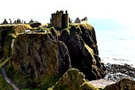
- 9. Identify this famous castle.. Dunnottar.
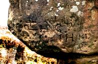
- 10. Where is this carving?. Below Laurencefield near Greenwood Farm.
11-15 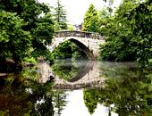


- 11. Where is this bridge? Froggatt village.
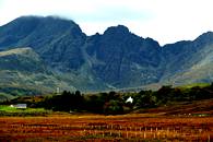
- 12. Name this famous Scottish traverse. Blaven Clach Glas traverse, Skye.
- 13. Identify this graffitied Peak District rock. The Cork Stone, Stanton moor.
- 14. Where are we? Birchover Quarry car park. (spot the car)
- 15. Identify the crag.. Ravensdale.
16-20 



- 16. Where are we?. Dundee, V&A museum.
- 17. Who dat? Christian Bonnington.
- 18. That's me 1958. Identify the route. Twin Cracks VDiff, Stanage. Left of Ellis's Eliminate.
- 19. Identify this Peak District pub. The Cock and Pullet, Sheldon.
- 20. Identify the route.. Fern Hill, Cratcliffe Tor.
The Winner, again (sigh) , was Adey Hubbard who got 17, fiercely contested by Dick Turnbull (16) on the grounds of non-appearance by Adey.
The prize, was a bottle of Screaming Eagle Cabernet 1992 or similar.
Below, a group shot of regulars at Awesom Walls, pre party. Hugh is showing his best profile. Should anyone want a higher quality shot, just let me know.
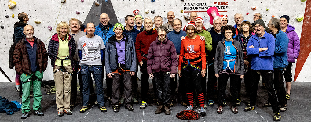
Party shots.
1-4 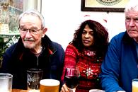
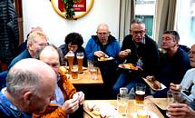
- John Jones, Annie Mays and Dick Turnbull taking it all very seriously
- The rumbustious end of the party crowd.
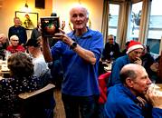
- Gerry presents me with an award for the overwhelming nomination of John Middleton as Grump of the Year for his overhang phobia.
- That's my award, it's a bottle of Christmas Pudding Gin Liqueur. John got the t-shirt.
1-5 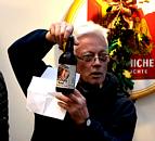
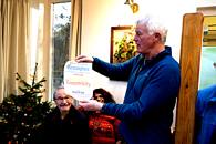
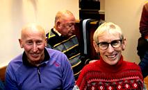
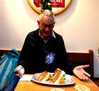
- Darrel presents an aptly named bottle of Grumpy Sod beer.
- Dick presents a new award for eccentricity, which has to go to Dave Clay, ref Finned Pilot Whale 2020 and more recently the dismembering of a dead deer.
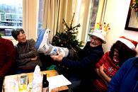
- MOC John Jones displays his prosthetic boot on his recovery journer from a ruptured Achilles tendon.
- Mike Waters and Sue Douglas.
- Brian Rossiter makes a courageous bid for the remaining slice of carrot cake.
Several absences this year.
So, awards. John Middleton was voted Grump of the Year 2022, in absentia.
Man-Booby prize. This somehow slipped through the net though it's not been an outstanding year. The Committee was torn between Jan and Adey's epic sojourns North and South and the excellent little article from John Graveling on the other Froggatt Edge, the New Zealand one. In the end, it went to John and Cath Graveling in absentia.
Adey Hubbard won the Diabolical Grumpy Quiz 22 with 17 correct answers, in absentia.
Due to some sort of double booking by my wife I have been unable to attend the annual Christmas Crack extravaganza on Stanage. However, Darrell has kindly bailed me out with a couple of excellent pics.
1,2 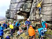

- The usual mayhem
- Take in, take in!

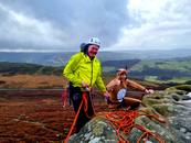


Here's a few more gems of Christmas Crack 22 from Rob Turnbull. Titles unneccisary?
1,2 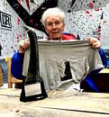
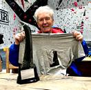
On Wednesday, John Middleton was awarded with his Grump of the Year t-shirt. Thanks Gerry and Eileen for thev shirt, Tony Mays for the pics.
- Disbelief
- At least I got a tshirt.
So, that is probably it for this year. Check out Next Year's starter. Happy New year to all our grumpies and keep on scowling.
Chris Jackson email
