Iceland by Campervan June/July 2008.
Words and pictures of a 4 week trip around Iceland by campervan. This was a splendid holiday with some breathtaking scenery. Non-commercial site with lots of links. Costs and travel details included.
chris and sue jackson e-mail
Click on any thumbnail image to enter the Gallery of larger images, slide show and picture details etc.
This was a place that we had not been to before, a place that we had never even previously discussed going to, and as our departure date grew ever nearer, and friends, heading for warmer climes started to say "Iceland? You're taking the Camper?" and "It's very expensive you know and it rarely stops raining" we began to wonder just what we'd let ourselves in for.
But to begin at the beginning. The ferry for Iceland on Smyril line leaves weekly from Scrabster which is near Thurso on the north coast of Scotland. Softies that we are, this seemed like a long way from Sheffield and it seemed like a good idea to include something else in our itinerary on the way. Suzy had never been to the Orkney islands and I had only ever made a fleeting visit on my way the climb the Old Man of Hoy and as that ferry also left from Scrabster it seemed like a logical objective and a chance to get used to island life. See the Orkney page for details of our trip there.
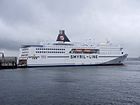
So, two islands? No, three. The good ship Narrona calls in at the Faroe islands on the way to the port of Seythisfjorthur on the east coast of Iceland. After leaving Iceland however it calls back at the Faroes, then heads for Denmark, calls back at the Faroes, then heads to Bergen in Norway before eventually reaching Scrabster once again. I can only assume that there is method somewhere in the madness. The bottom line is that we were to get 3 days in the Faroe islands on our homeward trip as we waited for the ferry to re-appear, and though it took less than 2 days to reach Iceland from Scrabster it was going to take 6 days to get back. Check on the Faroe page for what turned out to be a fairly spectacular place.
Before I start, let me apologise to any Icelandic readers, my computer doesn't have your two special characters, the pwith a stem above it (th as in thing) and the curved d (th as in the) so in all but plagiarised text I've had to replace them with a simple th.
June 26th and we had docked at Seythisfjorthur, a small town nestling at the foot of a deep glacier scoured valley. From the deck of the Narrona the lower hillsides were blue with vegetation which turned out to be due to lupins which have been planted all over Iceland in an attempt to improve the soil but, being non-indiginous are becoming a pest. I think that may have happened somewhere before! Although we docked at mid day we didn't actually get through customs and immigration until 2.00pm, they seemed to be having a purge on Czech and Polish visitors, emptying their vehicles onto the roadside and searching them. There were lots of camper vans in the queue but mainly German, Dutch, French and Belgian but very few British. Once allowed in we drove west over a bleak pass and down to the town of Egilsstathir where we did some shopping and stayed overnight at the campsite.
Campsites. We had envisaged the campsites in Iceland to be rather cold and spartan but most of them turned out to be indistinguishable from UK or European sites with hook-ups, hot water, cooking facilities, free showers and all spotlessly clean. Before we left the UK we bought an Iceland camping card for about £120 which gave us free access to some 33 sites around Iceland though hook-ups tended to be extra. Though we occasionally used sites that were not on our card, overall we made a decent saving. It is of course possible to wild camp outside of the National Parks provided that the land owners don't mind. Remember, no litter or dribbling of grey water, the Icelanders are quite rightly very particular about their environment.
June 27th. Clockwise or anticlockwise? I suggested anticlockwise anticipating that everyone would head clockwise down the coast on route 1 towards Reykjavik, Suzy disagreed, rationalizing that everyone would think that and that we should head south and clockwise. She was right, the roads were almost deserted.
Within 30km we experienced our first taste of gravel road which was reasonable except for the section of road works where the road surface had been reduced to large pebbles. Later, we were to realised that this section of gravel road was relatively good whereas others were well, variable, some being very smooth, some having pot-holes and some being corrugated aka washboarded, the worst. Tie down your crockery!
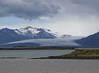
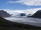
However, the gravel eventually reverted to tarmac and the scenery grew progressively more impressive as we drove along the coast. Huge coloured scree slopes bordered by deep ravines, cascades and steep bands of basalt ran down to the very edge of green fields where farmers were turning hay and we soon came in view of Vatnajokull the biggest glacier in Europe. It covers about 8% of the country and the average thickness is 400m. Under the ice-cap are active volcanoes including Grimsvotn, Iceland's most active since the Middle Ages which erupted in 1996, 1998 and 2004. Seven volcanoes are situated underneath Vatnajokull's ice-cap. See left picture. We stayed at the small town of Hofn overnight and next day visited the touristy but beautiful glacial lake of Jokulsarlon (second picture) where icebergs were peeling of the glacier into the water. We pressed on to the Skaftafell National park office where we managed to get some maps for walking, and stayed there in the capacious campsite. This was a beautiful place, wrapped by glacier arms from the ice cap, backed by woods and with stunning views of a myriad braided rivers spreading out across the deserts to the sea. From the campsite it was only a short walk to Svartifoss, third picture. Next day, maps in hand we took a full day's walk up through the woods alongside the Skaftafellsjokull glacier (fourth picture) over tundra and then rock and gravel to a splendid col with even more splendid views below a peak called Kristinartindar. The main peak seemed to be falling down faster that in could be climbed so we crossed the col and took a long circuit back. An excellent day out in splendid weather.
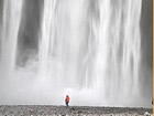
June 30th/July 1st. We left Skaftafell in lowering cloud and drizzle and crossed the strange glacial deserts known as sandurs of Eldhraun and Myrdalssandur where nothing grows and in windy weather the road can be closed due to flying grit which can strip the paint from your car. We stayed at Vik and next day and visited the fine waterfall of Skogafoss 62m. It was only minutes walk from the small car park and super little campsite, and it was possible to climb a series of steps to explore further falls on the hillside above. left picture, Suzy under the lower quarter of the falls, also see gallery. Behind Vik is the glacier Myrdalsjokull which harbours a dangerously active volcano Katla which last erupted in 1918 and is worryingly overdue for another eruption as they occur roughly every seventy years and of late there has been a worrying spate of earthquakes. Eruptions under glaciers cause jokulhlaups - volcanically induced flash floods which have had devastating effect in Iceland.
The wind had started to blow and by the time we reached our next objectives, the mighty cascades of Gullfoss (right picture) it was difficult to stand and almost impossible to hold a camera still. There was spray everywhere and most visitors were getting a thorough drenching. Impressive falls, and though not high by Icelandic standards their several drops and and the deep narrow gorge that they emptied into made for an impressive sight. The falls were almost sold to a hydroelectric company but thanks to the efforts of Einar Guðmundsson the falls were made into a nature reserve in 1979. Read more about how it all happened in the link. This however was another tourist trap, as was the nearby Stori Geysir which was a little disappointing, partly due to the wind which was blowing it almost flat to the ground and part because we'd been to Yellowstone. The wind continued to increase and the horizon and surrounding hills began to disappear into a grey haze of dust blown up from the southern deserts and so in an effort to get away from the wind and the tourist coaches we headed south again and found a pleasant uncrowded campsite in the town of Selfoss.
July 2nd. Wet and blustery we headed to Thingvellir an area remarkable for two things. First, it sits on top of the mid-Atlantic ridge which is the result of sea floor spreading between Europe and America; the Eurasian plate and the American plate are still moving apart. Thingvellir is full of rifts but the main rift, Allmanagja is widening at around 2cm every year. It was here that we first bumped into Mike and Chris Simpkins, climbers whom we were to get to know as we progressed around the island. Thingvellir is famous in Iceland for more than just rifts however, and no single place epitomizes the history of Iceland and the Icelandic nation better than Thingvellir by the river Öxará. At Thingvellir, literally "Parliament Plains", the Althing general assembly was established around 930 and continued to convene there until 1798. Major events in the history of Iceland have taken place at Thingvellir and therefore the place is held in high esteem by all Icelanders.
As foreigners it had a little less impact upon us than if we were locals but it was still a lovely place. In the afternoon the wind dropped and the sun came out and we managed some walking there though our 75000 scale map left a lot to be desired. Afterwards, we stayed the night in the spotless and almost deserted campsite.
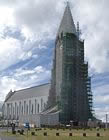
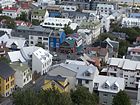
July 3rd. Raining so we headed to Reykjavik to see what it looked like. Well, grey and a little uninspired we continued south along the somewhat industrial routes 41 and 43 past the famous Blue Lagoon to Grindavik in the pouring rain. In all fairness, Grindavik is not the prettiest of towns and in the gloom and rain the small, free, overused campsite wedged in behind the sports stadium did not appeal, and in the end we retreated over the moonscapes of Suthurnes to a campsite in Hafnarfjordur just south of Reykjavik. We later heard that a new, large, posh (expensive?) site was under construction in the town. Next day the sun was shining and bright and early we headed for Reykjavik, a bit of a mistake for although there was lots of easy parking, in true Iceland style nothing opened before 10.00am. Still, it proved to be a pleasant place with parks and a lake and lots of chocolate box houses painted in cheerful colours. The Cathedral proved to be a modest place but Hallgrimskirkja church (left picture) was an impressive edifice in concrete which was finished in 1986 and seemed to be undergoing substantial repairs after just 22 years. I took the lift to the top of the spire and discovered some stunning views of the city, see right picture.
Now we were heading north with the intention of visiting Iceland's highest waterfall Glymur at 196m. After a false start up a delightful valley we found a small but popular car park at the end of a rough track. The footpath to the falls proved to be fairly scrambly and collapsing in places, with an interesting log bridge on route (left picture). The falls are deep within a gorge but by persisting with the path to a small look-out point it was possible to see them all, see gallery. It was also possible to do a circular walk which crossed the falls on the plateau above, madame was not keen however.
We camped just outside the small town of Akranes, coinciding nicely with a 2 day Irish festival to commemorate some early settlers. The place was packed and a fire would have wiped us all out. Not daring to move the campervan for fear of losing our place and the hook-up we made a long day out from the campsite walking over the Akrafjall mountains in thick cloud. This is where we learned that a green footpath line on an Icelandic map doesn't mean that there is a footpath on the ground. In the evening the anticyclonic gloom thinned, heralding a week of perfect weather.
On a recommendation from a Dutch couple, we diverted to the popular holiday area around the village of Husafel, west of Borgarnes. Well, the waterfalls of Hraunfossar and Barnafoss were splendid but that apart and the busy campsite and the lack of any sort of usable map from the information office made other activities difficult. right picture shows the gravel road from Husafel to thingvellir.
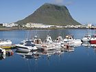
July 7th. We headed north and west to Vesturland and the Snafellsnes peninsula. This proved to be a magical place, the peninsula is quite volcanic and in fact has a semi-dormant volcano Snaefellsjokull at the western end. We headed for one of our free campsites at Kverna just outside to pleasant little town of Grundarfjordur. Left picture, Snaefellsjokull 1446m, next picture sea cliffs near Arnarstapi near the tip of the peninsula and right picture is Grundarfjordur marina with the peak of Kirkjufell behind. The peak is scramble-able with care and there is a circular walk around its base. While in Grundarfjordur we booked the ferry that would take us from the nearby Stykkisholmur to Brjanslaekur in the western fjords, thus avoiding a lot of unsurfaced road on the long way round.
We stayed several days at the campsite at Kverna which was run by a friendly German speaking Icelander. The site was big and fairly quiet which was a good job as there was only one combined toilet and shower. Using our Rother Guide which turned out to be almost useless we climbed the shapely peak of Horn starting from the lay by on route 56. This was a splendid day out with lots of strange rock formations and a peak which ended in a grassy point. The guide was of little help however apart from indicating our target and we could make little sense of the route description. The Snaefellsnes peninsula seemed like a place to come back to.
July 11th. The ferry to Brjanslaekur took just under 2 hours, and called in at the little island of Flatey which was, well, flat. We were now in Vestfiorthir which had something of the look of northern Scotland. We settled in a the pleasant little campsite at the nearby Flokalundur and took a walk up the hills behind to a hidden lake which turned out to be a lot further that I had estimated from our free walking sketch map.
July 12th. We woke up to rain beating on the campervan roof, rain which was to last on and off for the next 4 days during our visit to the western Fjords. However, there were things which just had to be done and one was to visit the most western extremity of Iceland at Bjargtanger and check out the major bird colonies on the huge sea cliffs of Latrabjarg which rise to 441m. Route 612 which leaves route 62 at the head of Osafjorthur is unsurfaced and though the route was spectacular in places the surface was generally poor, with killer corrugations behind the sand dunes beyond Hvallatur; the round trip was about 90km. The headland of Bjargtanger proved to be a bleak and desolate place with rain driving in across the Denmark straits and the sea, grey and white capped fading into a leaden sky. Cosy in the campervan, I declared that I was definitely not going out there in the wind and rain to look at a load of boring Puffins. However, while taking some lunch, a small Toyota Yaris pulled up beside us and disgorged two Icelandic couples dressed in tight jeans and pullovers, who immediately set off up the edge of the cliffs and disappeared into the cloud, oblivious of the weather. So we set off, the cliffs got higher as we progressed east along their edge and soon there were Puffins. Not just any old Puffins but Puffins so unafraid of us that we could almost have reached out and picked one up. It was so windy however that it was almost impossible to hold the camera steady and in any case I had attached the wrong lens assuming we would be viewing them from afar.
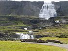
July 13th. North again crossing headlands and rounding fjords and just as we came to the spectacular 100m Dynjandi falls the sun chose to show its face, see left picture. This was a beautiful place which even had a small free campsite with toilet and water though the proximity of the falls mad it rather noisy. North again and this time over a 700m pass (right picture) through a wonderfully barren moonscape of lava and gravel. We eventually made the northern town of Isafjorthur after passing through a rather unique tunnel with an underground fork in the road.
The weather remained poor and we continued south and east in and out of numerous fjords, clocking up the road miles but making little real progress. I suppose that we were becoming immune to deep fjords, mountainsides and rushing cascades though in other places this coast might be a major tourist attraction. Eventually we met our old friend route 1 at Bru where we turned north once again to spend the night at Blonduos where we failed to find our free site and made do with the clean and pleasant town site.
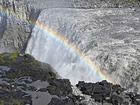
July 14-16th July. East now; we followed route 1 for a few more km then branched north to include the largely uninhabited Trollaskagi peninsula which would have been interesting had the weather not been grey and drizzly but by the 16th in clearing weather we arrived at the town of Reykjahlith on the shores of lake Myvatn. This was an interesting place, still vocalically active with lots of hot springs, volcanic cones, brightly coloured fumeroles and a large lake dotted with islands and rare ducks such as Slovenian Grebes. Nearby was the semi-dormant volcano of Krafla which last erupted in 1984. We settled in for several nights at one of our free campsites which had splendid views over the lake and village (left picture) and used it as a base to do some hill walking and visit various volcanic features. We also booked a bus trip to take us to the falls of Dettifoss for although it was drivable the road was said to be in poor condition and very corrugated. Second picture the amazing Dettifoss, with a rainbow thrown in for good measure, the journey by bus across virtual moonscapes really didn't prepare us for this monster. We were told that in times of flood its flow exceeds that of the mouth of the Amazon. Next picture a Golden Plover, next, the wonderful solfataras of Hverir, next Hverfjal, last picture a view across lake Myvatn from the lip of Hverfjall crater.
July 19th. North again, first up the gravel road of route 87 then onto the delightful little town of Husavik which seemed to be the whale watching centre of Iceland. We continued round the tip of the Tjornes peninsula, on past the outlet of the variously named Bakkahaup river which had so impressed us at Dettifoss, then north again towards the northenmost tip of Iceland at Hraunhafnartangi on the Melrakkasletta peninsula where there is a lighthouse that is just 2.5km from the arctic circle. In truth, it's not quite the most northern part of the island, a small peninsula to the west called Rifstangi actually claims this by a few hundred metres. We didn't actually get out of the campervan at this point, warnings about ground nesting birds nearby, and previous experiences with Arctic Terns put us off walking the last couple of hundred meters but it was a clearly visible line across the sea. We carried on pottering down the east coast of the peninsula, knocking off the odd sight and doing the occasional walk as we went. The weather was still warm and pleasant and we stopped overnight at the small town of Raufarhofn where there was an excellent small clean campsite that was completely free.
July 20th. Back at Egilsstathir and back where we started nearly 4 weeks ago. We shopped, filled up with diesel and I washed the campervan at one of the free car N1 petrol station washes. We had discussed with Mike and Chris spending our last few days in Iceland in the Eastern Fjords at Bakkagerthi and the day after we arrived they turned up in their demountable campervan to join us. Bakkagerthi was a lovely place and we did a walk together and visited the Puffin colony a little way along the coast where they were not quite as tame as they had been at Lattrabjarg. Top picture Puffin with sand eels, below, Bakkagerthi.
Above, Left to right, Flowers of Iceland, The Faro Islands and The Orkney Islands.
Some Details 2008.
Ferry: Smyril Line 'Norrona' £880 for 5.9m campervan, driver and one passenger, inside cabin, return from Scrabster.
IMPORTANT currently (2010) the ferry no longer runs from Scrabster and has to be joined in Denmark, making for a more complicated journey. Due to current economic situation in Iceland, costs will have changed.
- Ferry Time: Scrabster to Seythisfjorthur about 18h. Seythisfjorthur to Scrabster 6 days. (includes 3 days on Faroe islands).
- Diesel: Iceland as per UK £1.35/L
- Campsites: Around £10 + £2-3 for hook-up
- Food: Variable but assume £UK x 1.5
- Alcohol: Around 2 - 3 x £UK
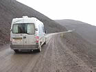
Driving: Iceland drives on the right with dipped headlights at all times, and despite warnings of erratic driving by the locals we found them courteous and responsible. We probably covered 300 miles of unsurfaced road during our 2000 miles of driving in Iceland. Some of the unsurfaced roads were quite good, hard and smooth but others were potholed though with a little dodging the worst of these could be avoided. The worst surface was washboarding, corrugations which at worst could enforce speeds as slow as 5mph. Generally, we found it possible to maintain 30mph on medium corrugations, 40+mph on better quality unsurfaced roads. Always slow down and keep well in to the right when passing oncoming traffic, they will usually do the same. Keep a sharp eye on the road, most roads are on embankments and few, even with terminal drops down the side, have any sort of barrier. Road numbers prefixed with an F are for 4x4 vehicles only.
The interior tracks of Iceland requires special skills and special vehicles and the normal roady 4x4 will not get far. The glacial rivers are particularly dangerous and people are regularly lost attempting dangerous crossings in their car. I don't profess any expert knowledge but the rules seemed to be - wear a life jackets and safety lines, travel in groups of 3 or more and have a vehicle with a winch line so that you can be dragged out, and only one at a time in the water. What do I know?
The vehicle of choice by Icelanders seemed to be the trailer tent, as this allowed the towing vehicle - usually a 4x4, to be used on the rougher roads. Demountables were also popular for the same reason. Having said that, campervans were very common amongst both locals and visitors, caravans less so because of the sometimes poor road surfaces.
Maps: Despite assurances from the Rough Guide and other sources we found it almost impossible to obtain decent walking maps from information offices or National Parks. Even in Reykjavik we struggled to find anything better that 1:100000 and it would seem advisible to select your regions of interest and source maps when in the UK (or wherever).
Vehicle: Timberland Endeavor Renault Master conversion.


