![]()
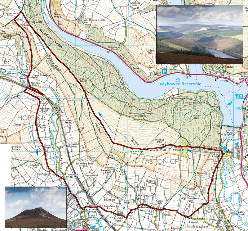
Peak Walks 16: Win Hill and surroundings.
- Map: OL1, 25000 series The Peak District Dark Peak area.
- Distance: 16km/10miles
- Time: 4.5 hours
- Ascent: 450m.
- Inset: Ladybower Reservoir and below, Win Hill summit.
Park close to the Yorkshire Bridge Inn at SK202852 on the A6013 Bamford road, or failing this, take the small road about 200m on the Bamford side of the Inn, parking can usually be found at the bottom of this lane by the bridge.
From the bridge, the route starts up Parkin Clough which is quite steep and may require a measurerd pace. Cross the bridge, turn right, pass through a gate and after a few metres take the steps on the left. Cross an old railway level then continue unrelenting to where it meets the easier approach beyond the woods. Continure straight up steps to the rocky summit of Win Hill.
Alternative, less steep, turn left over the bridge and follow a pleasant track to the right, cross the old railway level and after a further 800m join a main track (often muddy) originating in nearby Thornhill and leading up and right. This will eventually take one to the summit of Win Hill where there may be stunning views in every direction.
From the summit take the long easy slope West for about 4 km, pass a plantation of pines to the inscribed Hope Cross an ancient packhorse crossing point. Pass through a gate and enter a rocky lane for 200m. At the top of the lane is a prominent signpost. Turn left, and after about 200m take a sunken grassy lane on the left. Follow this to Upper Fulwood Farm which is a National Trust office.
Follow the track to the main road and turn right, or better, take the path which starts just over the bridge and leads straight up to the road. Turn right, cross the road and take the track which passes unnder the railway. After 50m turn left onto a grassy track across fields past Oaker Farm and several guest houses. Follow the lane to where it joins a minor road, turn right and continue past the Cheshire Cheese Inn. After the Inn turn left onto a minor road and Killhill bridge over the River Noe. After about 100m follow the broad footpath on the right which passes under the railway and after Birchfield joins a minor road. Turn left onto this and follow this undulating road through Aston. After Aston Hall the road narrows and some 500m after the Hall take a footpath on the left.
Cross several fields, pass a small wood and cross the easier ascent path mentioned in the start of the description. After some 800m the path crosses the old railway level and drops down to the road close to the bridge.