![]()
Peak Walks 2. Hathersage, Higger Tor and Stanage.
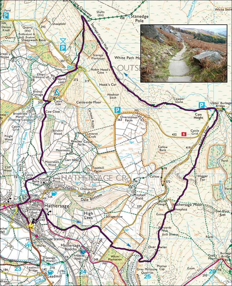
- Map: OL1 The Peak District Dark Peak Area.
- Time: Allow 4 hours walking time.
- Distance: 13km / 8 miles.
- Ascent: 440m
- Inset: the ancient flagged path below Stanage.
An excellent upland walk starting in the Derbyshire village of Hathersage. Parking is often possible on the station approach just outside the village on the Grindleford road. There is also a PAD carpark nearby.
Start. From the station approach turn sharp right into Back Lane and follow this to the main A6187 road. Turn right and after about 150m fross the road and take the footpath on the left. Follow this, steeply past several houses into a wood, the path zigzags left then progressively up and right eventally immerging in open country. Keep right, join a surfaced track and follow this down to a minor road. Dogleg right, cross a stile and take the path that climbs diagonally left across Little Moor, owned by the National Trust. At a path junction continue uphill towards an outcrop of rocks Over Owler Tor. On meeting a larger footpath turn right and follow this until a footpath on the left leads into the Tor. Take the path through the Tor, turn right and head for Higger Tor which is visible (in clear weather) straight ahead. The small road should be down to the left, Burbage valley and Green Drive down to the right. Continue slightly east of north and at a fork keep right past a large sheepfold and up steeply to the top of Higger Tor.
Maintaining roughly the same direction follow well-trodden paths parallel with the minor road on the left, across the moor eventually reaching Burbage Bridge and the carpark where there is sometimes refreshments. At the road turn left and at the sharp bend continue straight on towards Stanage Edge. The path steepens as it reaches the Edge, follow if leftwards to a trig point 457m. Follow the rocky top of Stanage Edge for about 1.5km. The descent path can be tricky to locate in poor weather but after crossing a wooden fence, keep on past a track junction and in another 30m look for a rocky track descending left. The track is well-worn by a million feet and is probably medaeval.
Follow the track down to the road and take the path signposted Hathersage and Bamford at the side of a small building. The path passes North Lees Hall, the inspiration for Thornfield Hall in Charlotte Bronte's novel Jane Eyre, eventuall arriving at a small road. Turn left and as the road begins to rise take the footpath on the right. This passes above Cowclose farm and then traverses fields and passes through a stone wall before dropping off on the right in the direction of Hathersage church. At the bottom of the hill turn right and at a track turn left. This will deposit you on the main street of Hathersage.
Turn right and at the road junction turn left, 0.5 km to your starting point.
Particular interest: Stanage, Carls Wark, Higger Tor