![]()
34. Matlock, Ible and the Limestone Way
- Map: Explorer OL24 The Peak District
- Time: 6 hours
- Distance: 18.7km/11.7 miles
- Ascent:500m
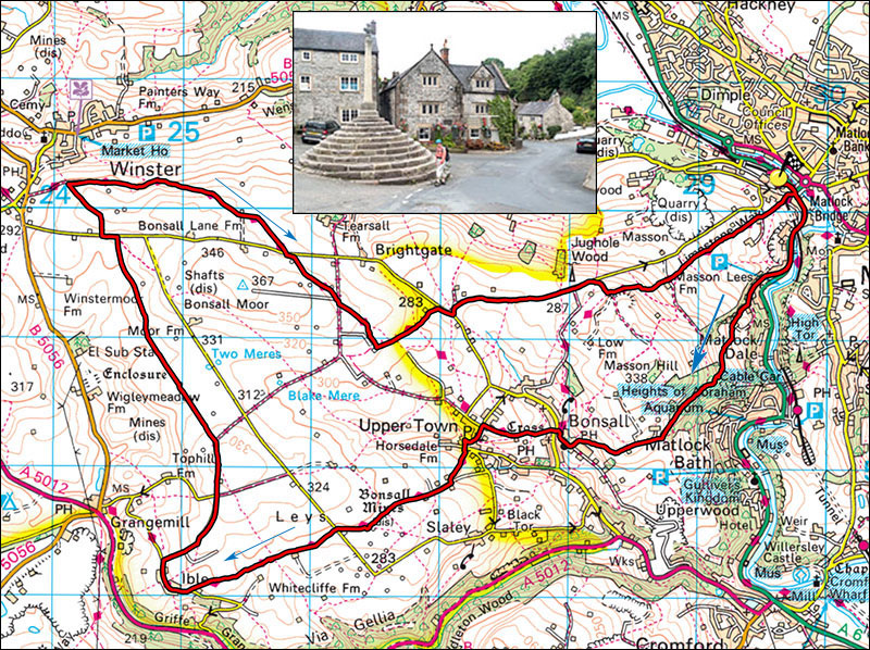
- Inset: Bonsall and The King's Head.
A long but gentle walk across the splendid wide limestone uplands of the Southern Peak District. There are ample options for short cuts and in July and August the wild flowers on the old spoil heaps are quite stunning.
Start at Matlock PAD display carpark SK297602 next to the railway station. Walk down the main road in the direction of Cromford for about 500m to a small road ascending steeply on the right. Follow this past an abandoned church and at a gate blocking the road take the small footpath on the right. This works its way upwards, past the Heights of Abraham amusement park before entering pleasant woodland. The path contours the woods eventually emerging in an open area. Turn right past Ember Farm and follow the small road down into Bonsall.
In Bonsall pass in front of The Kings Head pub (presumably Charles I who lost his) and keep straight ahead to a set of steps climbing out of the valley to the very pleasant Upper Town. At the T junction turn left and continue down the road (Don't turn right) into a valley of lovely old cottages. At the bottom of the valley take the footpath opposite, The Limestone Way. The path zigzags up into fields, the path trends a little to the left, passes through a gap in a hedgerow and heads towards a ruined barn. Shortly before the barn the path swings left through a belt of trees to join a narrow lane. Turn right and follow this to open fields.
The path is now waymarked all the way to Ible and passes many old spoil heaps that are redolant with wild flowers in the summer. After a pit, the path swings right and passes through a double gate. Keep an eye out for the next stile or gate. The path crosses a minor road and keeps to the right of Leys Farm and Whitecliffe Farm. Do not take the tempting gate on the left into nettle fields but maintain roughly the same direction until arriving at the small road leading into Ible, a collection of farms.
Turn right and pass through Ible and take a minor road on the right. Follow this for about 1km to where it turns sharply right onto Blakemere Lane, here, take the footpath straight ahead. Follow this path across pleasant field for about 2km to a minor road, Bonsall Lane, turn left and after about 100m take the footpath on the right. Follow this over the rise to where there are stunning views of Winster, Birchover and Stanton Moor. Continue to a lane which is the Limestone Way and turn right onto this. Follow this for 2km to a minor toad (Bonsall Lane), turn left and after a few metres pick up the continuation of The Limestone Way on the right.
Follow a series of stiles, cross Blakelow Lane and continue following stiles, bearing left at one point until Moorlands lane. Turn left on this and after about 400m arrive at a minor road. Turn right and then shortly left onto Salter's Lane and after 1.2km take a broad gravel lane on the right which crosses The Limestone Way running up from Bonsall. Turn left onto this and follow the well-signed path down into Matlock.